ALSTON MOOR: ‘A LEAN and HUNGRY WASTE’.
 

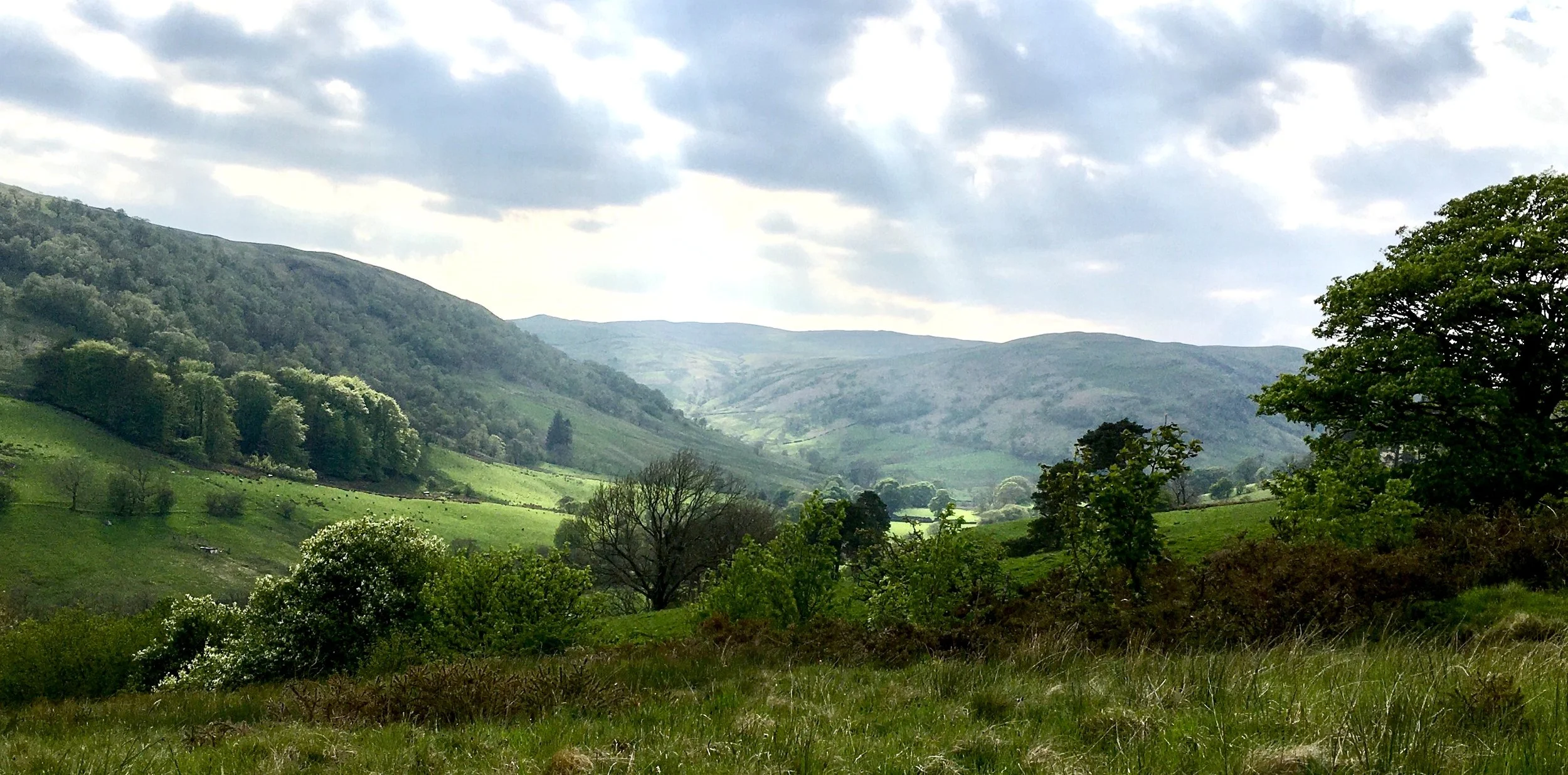
The 16th century antiquarian William Camden dismissed the North Pennines as a ‘lean, hungry waste’, and certainly on Alston Moor it is generally an overcoat or two colder than Penrith. Climbing up and away from the gentle Eden into these wind-ploughed uplands, the keenness of winter can take your breath away. Even in more benign seasons the high hills can lie sullen under mist or strafed by skirling cloud shadows. To W. H. Auden it was ‘the wet road between the chafing grass’ and the contours of industrial ruin. The dismantled washing-floors, snatches of tramline, pitheads and levels, gradually dissolving into the middle distance. Yet perhaps more than anything it is a landscape of contradictions, of history on the edge, set within tidal moorland boundaries, multi-layered and mercurial; difficult to get to know, yet more than worth the effort.

 William Hutchinson, visiting the town of Alston in the 1790s, was singularly unimpressed. In his History of the County of Cumberland he describes Alston as, ‘…a small market town, meanly built … in a narrow valley over which mountains frowned with a melancholy sterility and nakedness.’  He goes on to complain about the bad roads, and the ‘mountainous, barren and inhospitable country’. In describing the weather he is positively enthusiastic, ‘…impending clouds stretching forth a dark and disconsolate curtain over the face of morning, rain beating vehemently against the windows, a few trees standing near the inn tossed by the heavy blasts which howled down the valley.’ He also makes the curious point that as the people are ‘generally subterraneous…in no place is there a greater scope for contemplating peculiarity and novelty of character.’ Sadly he fails to elaborate further.

 Under such circumstances he can perhaps be forgiven for having failed to notice the curious array of vernacular buildings in Alston Moor, the special nature of which appears to have been largely overlooked until Jollies’ 1811 Cumberland Guide and Directory. Here are described a few buildings of a ‘singular construction’.

 The walls of which are very thick and strong and besides the little well secured windows often contain a sort of portholes. The cattle and their owners reside under the same roof the former occupied the ground floor and the latter the upper story.

 Rare survivals of vernacular buildings pre-dating the 17th century, include remnants found within the ruined farmstead at High Lovelady Shield, but what Jollie was referring to was Alston Moor’s most characteristic farmstead type, the bastle house. Built as a response to the harsh environment, narrow doored, squint eyed and belligerent, they also served against periods of insecurity and instability. Alston Moor stood in a precarious position, just to the south of the Middle Marches of the highly troubled and much ‘debated’ Anglo Scottish border and close enough to Tynedale to attract some fringe activity. It was, as Edmund Sandford describes in 1670, a ‘rich grassing ground with great herds of cattle and flocks of sheep’ where livestock represented a farmers most valuable movable asset. At Annet Walls near Alston, the 1672 probate inventory of yeoman farmer Thomas Walton gave no value for his house or land but solely for his movable goods, totalling just over £30. They include his horse, eight cows, five heifers, four carves and twenty sheep, with the rest of his household goods, valued at just £3.

 Twenty years later Thomas Denton wrote that the people ‘live upon their stocks and convert most of their enclosures to meadows the place being too bleak and stony for arable ground’ yet there is evidence to the contrary. In 1730 the tenants of farms at Bales and Fairhill admitted that they had been growing oats and barley for the previous 15 years. As a reward for their efforts they were prosecuted for the non-payment of tithes.

 By the mid 17th century bastle houses had become the predominant building type, encouraged by land leasing reforms which provided secure long-term tenancies, and consequently the confidence to invest in land and buildings. They were often strung along the contours in small groups as Thomas Denton describes, ‘straggling all over the parish as if they were afraid, one of another’. Generally they were built on a rectangular plan with a ground floor byre for the cattle and accommodation for the farmer and his family above, reached by means of a wooden ladder. Heather thatch was the preferred roofing material, the steep pitch associated with this material can be seen in roof scars at Lower Crossgill and Blagill.

 Significantly the bastles of Alston Moor used flagstones on timber joists, rather than stone vaulting, to form the first floor, as evident at Annat Walls, Low Park and Middle Bayles. This local adaptation took advantage of the rising warmth from the cattle in winter and perhaps also, the more readily available materials. Even in the town of Alston the tradition persisted, with three storey, first floor entrance, bastle derivatives lining the older streets.

 Most fundamental however to the development of the landscape of Alston Moor are the mineral veins, those stuttering black lines representing richly mineralized faults, which criss-cross the geological map to form the complex North Pennine orefield. From Roman times onwards lead and silver have been the region’s best known natural treasures. The 12th century mint in Carlisle obtained silver from Alston and lead was supplied for building work on the great monastery of Clairvaux in north-east France. Mining was so extensive at this early date that disputes arose concerning the excessive tree felling for use as fuel and pit props and remained a bone of contention for centuries to come.

 Mines were leased to Germans in the 14th century and again in the 16th and passed through many hands, including the London Lead Company, a Quaker organization remarkable for its philanthropic ideals. At Nenthead the company built a whole new village, cottages with gardens, sanitation and a water supply, and since earnings had depended on the fluctuating price of lead, guaranteed a minimum wage. Production reached a peak in the early 19th century, fifty years later deposits were depleted, and cheaper foreign ores flooded the market. The London Lead Company abandoned the workings and the population fell into a steady and devastating decline.

 Yet for some this ‘cradle of industrial desolation’ had a very particular appeal. It was the landscape which first inspired the 15-year-old W. H. Auden, tramping across a deserted moor in the North Pennines in the summer of 1922. At Sike Head shaft, on the slopes of Bolt's Law, he found the imagery that would haunt much of his later work, the poetry of ghosts and grey skies, shattered ironwork and rust. On the wall of his workroom at Fire Island in New York at the height of his fame, he hung a map of Alston Moor; yellowed and rolling at the edges, a treasure from his childhood.This expanse of moorland was his earthly paradise: ‘I could draw its map by heart, / Showing its contours, / Strata and vegetation/ Name every height/ Small burn and lonely sheiling…’ (Amor Loci, 1965).

Born two years later than Auden in the village of Nenthead, Eric Richardson the ‘mineral diviner’ shared this early fascination with the mines. As a boy he would creep into the workings when the miners were absent, or on Sundays, along with all the other village boys, gather there to ride the wagons. While Auden’s recollections from the 1920s were of dereliction, Eric recalled that the Alston Methodist Circuit could muster eighty local preachers including Jacob Hill the blind evangelist who raged from the pulpit. Then there were the community trips to the seaside which began with a procession of horses and carts to the railway station at Alston. He never forgot the clatter of clogs as the miners went to and from work or waiting at the mine entrance watching for the candle light that signified his father’s return.

 Tragically Eric’s father died young the result of a mining accident, but despite this, Eric followed him down the mines, not only in Alston Moor and Teesdale but also the Lake District. In retirement the world beat a path to his door, geologists from Europe, professors from American universities, eager for his extraordinary knowledge and tangible link to the past. He continued to revisit those dark places, searching out traces of the ‘t’Awd’ men, as the past generations of miners were referred to, and discovering bats roosting in the abandoned levels threequarters of a mile from the open air.  For Auden this was a place of revenants, for Eric it was a life-long, all consuming, fascination.

At Nenthead the almost lunar landscape of dereliction I remember from childhood has been reclaimed. Eyebright and harebells border the former smelting mills along with the extraordinary fleshy fern known as moonwort. The mountains of ‘deads’ have been colonized by the pale stars of pink and white spring sandwort. Even on the steepest, rawest banks of waste the blazing ragwort glories in its tenacity and mountain pansies scatter the long grass. Lichens encrust both stone and metal and, on the ground, form a biotic bark over the bare soil protecting it from erosion and allowing small bryophytes and plants to establish. Most important in this community are the microscopic fungi which grow on lichens, in Britain known only from five sites, all close to Nenthead.

Lapwings, redshank, snipe, and golden plover populate the moorland where fluorspar still glitters on the mountain tracks, and once on an early summer day under a mass of moth-eaten clouds I was stopped in my tracks by a reverberating rumble with the velocity of a chainsaw. It was in fact a mass gathering of fiercely chorusing frogs, what seemed like hundreds of them in the damp ditch and across the track, vying with each other in their rich baritones. But also there is the darker side of the moor, the crates of bewildered young birds imported to these high places for the sole purpose of being blasted to oblivion under the farcical conditions of the ‘driven’ grouse shoot. A mindless slaughter made more senseless by the use of high-powered modern weaponry, oxymoronically called ‘sport’, that leaves little to either chance or skill.

The historically much plundered North Pennines now remains one of England most unsuspected treasures. The town of Alston, a cobbled, vernacular gem at the crux of three counties and beyond the vast, tawny, hare-haunted uplands and sparsely populated dales, erupting every springtime with subalpine wild flowers. Flowing through them are the peaty gills and sikes that feed the great rivers of the North East. On Alston Moor in the height of summer, in a world of contrary winds and untidy perfection, I often wonder how such a place can remain so overlooked, but I am grateful that it is.

 First published in Cumbria and Lakeland Walker November 2024. 

 
Deborah Walsh
SCRATCHING THE SURFACE: THE ECCLERIGG AND BAYCLIFF INSCRIPTIONS.
 

A man kneels on a quarry floor beside a lake. Close at hand is a small bag, and in it is a set of chisels, a mallet, chalk and a ruler. His head is full of words, yet he works meticulously, inscribing each letter near perfect in symmetry and form. For six years, by day and night, his clandestine work continues, the sound of his rhythmic tapping ringing across the water. On a different shore, thirty miles away and a hundred and fifty years later, another man runs his hand over the smooth limestone bedrock and bends to the same purpose. The first is John Longmire, whose family had called Troutbeck their home since the 16th century, and the second, engineer and carpenter, Bill Stables of Ulverston, who died in 2000 aged 85. The two men carved messages, ciphers to the future, and in so doing revealed that complex relationship between language and manufacture, between making words and making things.

According to Charles Mackay, in his 1856 The Scenery and Poetry of the English Lakes, Longmire ‘was, as our boatman took great pains to impress upon us, rather 'dull' at the time’. He explains that the phrase, in this part of the country, implies that he was ‘deranged’. But Mackay, who incidentally was the author of the book,Extraordinary Popular Delusions and the Madness of Crowds, seems to have found meaning, ‘solace under calamity’, where the boatman saw only wild eccentricity. He concludes that, ‘There was a method in the work, which showed that his sympathies were in favour of the moral and intellectual advancement of mankind; and that …he could do honour to those whose intellect had benefitted and adorned our age’. Clearly Mackay’s curiousity was piqued, but he could discover no more, ‘our friend the boatman being unable to say whether he (Longmire) was dead or alive ...".

A little more information can be gleaned from Lakeland writer John Wilson, who forty years later noted that on Ecclerigg Crag at Craam’s Bay (White Cross Bay), on the eastern shore of Windermere, ‘John Longmire spent some six years of the prime of his life with mallet and chisel, in the task of letter cutting which to him was a pleasant but unremunerative task’. Yet John Longmire still remains elusive. Sometimes he is referred to as police constable in Ambleside, and at others as a monumental mason residing at Troutbeck Bridge. Most likely, he was both, first a skilled stonemason and later, in 1845, at the age of 50, assuming the role of policeman.

Ecclerigg Crag quarry was an important source of building stone which operated periodically from the late 18thcentury, when stone from here was used to build the Rotunda on Belle Isle, until 1910 and the construction of the nearby Crag Wood House. On the quarry floor three main slabs are visible, though more lie just below the surface of the lake, some horizontal, the rest inclined at various angles, all bearing precisely carved inscriptions.  Scrape away the moss and leaves and the words erupt from the rock, somewhere between a curious cryptogram and the ruins of a classical city forcing its way back to the light.

Dr Blake Tyson recorded the inscriptions, published in an article for the Transactions of the Ancient Monuments Society, 45 years ago. Since then many have been subsumed under the scrubby canopy of oak, hazel and alder at the water’s edge, blanketed in mosses and leaf litter. He records that four of the slabs are dated from 1835 to 1837, with two further fragments lying just within the lake, where the waters lap against the word ‘Neptune’. Frost and other hazards have taken their toll, but most destructive was the quarrying of stone for Wray Castle in the 1890s. The earliest dated slab, inscribed ‘LIBERTY’, is the largest and lies in the middle of the quarry, its letters in raised relief. In a sense this first inscription is the key to the rest.

Mackay, who marvelled at the inscriptions in their entirety, less than 20 years after their creation, describes them as ‘the greatest curiosities of the place… with every smooth surface afforded by the rocks - every slab on the stratified formation, covered with inscriptions … in letters varying from six to twenty or twenty-four inches in height.’  He records one large red stone of at least ten feet square, with the date '1833’ and the words ‘MONEY. LIBERTY. WEALTH. PEACE.'  Others read, 'A SLAVE LANDING ON THE BRITISH STRAND, BECOMES FREE’, ‘THE LIBERTY OF THE PRESS’, ‘MAGNA CHARTA’, ‘NATIONAL DEBT £800,000,000’, (perhaps referring to the costs in the Napoleonic War) ‘O SAVE MY COUNTRY, HEAVEN!’, 'MONEY IS THE SINEW OF WAR.' One immense surface of rock bore the names, 'DRYDEN, DAVY, BURNS, SCOTT, BURDETT, GARRICK, KEMBLE, GRAY, KEAN, MILTON’.  Other names dispersed about include politicians: ‘HENRY BROUGHAM’ and ‘WILLIAM PITT’, scientist ‘DR. JENNER’ and engineer ‘JAMES WATT’. Literary figures include ‘WORDSWORTH’ and ‘J. HOGG’ the ‘Ettrick Shepherd’, Polar explorers ROSS and PARRY and national heroes including, 'FIELD MARSHALL WELLINGTON’, ‘HEROIC ADMIRAL NELSON’ and ‘CAPTAIN COOK’.

Names which are less familiar refer to local benefactors including: Matthew Piper a Whitehaven Quaker who endowed National Schools in Lancaster, Kendal and Whitehaven, and left a substantial legacy to feed the poor of Whitehaven. One which sits less comfortably in this testament to liberty is that of John Bolton of Storrs Hall who made his fortune in the West Indian slave trade. His inclusion here relates to his local charitable donations. As does that of Giles Redmayne, of Brathay Hall and Lydia Freeman, the only woman commemorated.

General Lafayette, the lifelong republican, is also present. Described by Thomas Jefferson as ‘the doyen ... of the soldiers of human liberty’, he fought for the Colonists in the American War of Independence and commanded the Paris National Guard in the French Revolution. Robin Hood also, understandably, gets a mention.

But perhaps most striking is the single word ‘STEAM’ which sits alone like an exclamation. The image of Turner’s near contemporary painting, ‘Rain, Steam and Speed’, inevitably comes to mind with its locomotive exploding through the sulphurous rain into a new world; the sublime convergence of technology and natural forces, the wonder of the age at 36 miles per hour.

As a curious aside, John Wilson, in response to the heated debate concerning the ‘Rock of Names’ at Wythburn, and how much Coleridge and Wordsworth could actually have carved with a penknife, pointed out that it was ‘…pretty well established, that the rudely carved scratched initials were the work of a rather clever but eccentric amateur stone-cutter who adopted the business solely for his own recreation and was in the habit of occasionally spending a few days near to Wythburn. His name was John Longmire, who was for some years active as paid parish constable for Ambleside.’

That Longmire added a more ‘professional’ finish to the original scratched initials is entirely plausible. His motivation may well have been a desire preserve the originals, but also, as with his work at Ecclerigg, as an act of homage.

In another, very different place, a quiet wooded coast where the humic smell of damp wood and earth meets the sharp tang of wet sand, Bill Stables worked on his own inscriptions. Bare chested and supremely fit he walked every day to this his favourite bathing spot beyond Bardsea, at Baycliff.

 Bill was a carpenter by trade, well known for his craft and engineering skills. His famous steam-driven model carousel, which took eight years of his spare time to hand carve and build, was based on the machines which were a common site on travelling fairgrounds from the 1880s to the 1930s. Among his other steam-powered models was an Emerson and Hazard engine, called Gavioli Bill, built with the aid of photographs and his own memories of similar engines in use. Bill but never lost his enthusiasm to learn new techniques and in later life these included stone carving.

 His style in all respects was very different to Longmire’s. His letters small, free flowing capitals lightly but evenly incised, stylistically less the monumental mason and more the maverick. For his rock he chose a flow of bone grey limestone where water worn channels snake, forming shingle scoured pools. His words flow down a single plane beginning with a simple thank you to Baycliff ‘FOR ALL THE WONDERFUL SUMMERS…’. the year ‘1977 AD’ and the silver jubilee of Queen Elizabeth II. It continues with a complaint about ‘SOCIALISM’ and the ‘UNCHRISTIAN SOCIETY’, with references to the industrial troubles of the time. Another panel provides a long list of all his fellow ‘ALL YEAR ROUND SWIMMERS’, from a time when swimming was just that, and nobody had thought it necessary to prefix it with the word ‘wild’. And finally his ‘GREETINGS TO THE PEOPLE OF 2077 FROM US BOYS AND GIRLS…’.

 These are the messages of the moment, a little at odds with a landscape where sand and water shift endlessly; but perhaps, subliminally that was the intention. Bill would have known this place in every light and at every turn of the tide, from acres of sand smeared by grey water, where stick-legged oystercatchers are constantly busy to the times when the water is close and restless. For a man who did not want a gravestone, this is his place to be remembered. Here there are no beginnings and no ends, no boundaries and true to place, where even his words are slipping off the stones, syllables dissolved in water.

 People have always carved their names into rocks, craving connection with the infinite, or as near to it as might be managed.  The quarried faces at Wallthwaite, the summit of Caw Fell, the cliffs at Fleswick Bay, a gate stoop at Rosthwaite and innumerable other places, have become ‘visitors’ books’, vehicles of posterity, fragments that say, ‘I was here’. But Longmire and Stables were more ambitious. They left their cryptograms, and whether slight or grandiose, the philosophies of two ordinary men with the determination to articulate ideas that may dissent from the mainstream.

 But in Longmire’s work, however cryptic, there remains something unsettling. The convulsion of words that Mackay marvelled at 170 years ago, with its telescoping of complex ideas into concise messages, is now fragmentary, choked by time and neglect into near silence. Yet Longmire carved his letters deeply and those themes of war, debt, liberty of thought, press freedoms and the tensions between technological advance and humane values, remain, not only written in stone, but as the same profoundly pressing concerns for our own times as they were nearly 200 years ago.

First published in Cumbria and Lakeland Walker October 2024.


Deborah Walsh
RAW HEAD, GREAT LANGDALE: At the still point of a turning world.
 

Raw Head Cottage, whitewashed and neat with its vivid sage green window frames, exemplifies that little piece of perfection, the quintessential Lakeland farmhouse. The fellside of Langdale Edge rises steeply at its back where an outgang links with the Raw Head sled road used for gathering sheep and bringing down the peats. Beside it Scale Ghyll scrabbles amongst the rocks in short falls and sheep wander in the garths and shelter between the buildings. Yet within those walls, settled into this landscape for more than three hundred years, is something yet more remarkable, one of the best 17th century interiors in the Lakes.

 Entering the cottage on a summer’s day, one’s eyes take a while to adjust to the low-ceilinged dimness. The sitting room with its two south facing windows look out across valley, to the great wall of Lingmoor; but inside there is the warm glow of old oak, rich and stained by years of coal fires and before that, peat. With it comes that enveloping sense of time moving a little slower. It is a special place, cherished for the last 80 years by its present owners, the Fell and Rock Climbing Club.

 Tom Buntin, who farmed down the road at Robinson Place, described Raw Head cottage thirty years ago as ‘beautifully preserved inside and … very much as it was a few 100 years ago’. Yet of course there have been significant changes since Thomas Tyson farmed here in the 1670s, and the present house was built and furnished by the Harrison Family with its splendid press cupboard, a decade or so later. At this time, before the present road was built, it lay at the head of a lane called Row Lonning and like all of these farms, it has passed through many hands. In the 18th century, there were the Dawsons, Allinsons, Graves and Parkers amongst many others until it was bought by John Robinson of the Elterwater Hall estate in the mid 19th century. In 1944 it ceased to be run as a farm and was sold to Cyril and Sarah Bullmann of the Dungeon Ghyll Hotel. The cottage was leased to the Fell and Rock Climbing Club and eventually the cottage, barn and curtilage was sold to them in 1947.

 What is so remarkable about Raw Head is not only the survival of the original layout of the rooms, with fire-room, parlour, buttery and down-house, but also much of the original timberwork. The fire-house (or sitting room) retains the original heck, a timber partition to reduce the draught from the door. Originally a fire hood would have covered the ceiling space from the heck across to the front wall and forward to the fire beam (bressummer), the space lit by the small fire window. The peat fire on a slab under this hood would never be allowed to go out completely. When coal began to arrive through Whitehaven and Maryport in the late 18th century, fire hoods became redundant as coal did not require as much draught.

 But the focus of the room is elsewhere. On the facing wall to the fire is an elaborately carved press cupboard, a superb expression of place and permanence, bearing the initials and date ‘THH 1689’. Used to store the best plates, cups, pewter, silver as well as foodstuff such as haver or clap bread, the date is typical of those in the district and close to the date when the house was built, or possibly rebuilt on the same site.

Although virtually all rural houses of ‘middling’ status in England and Wales were furnished with press cupboards, only in the counties of Westmorland and Cumberland were they routinely built-in. Here also are the largest number of dateable examples. The renewed confidence that emerged with the legal confirmation of tenants’ rights under the system of border tenure seems to have been the motivating factor with widespread rebuilding of farmhouses throughout the Lake District in the 17th century. The built-in press cupboard is a symbol of that security and permanence and the glory of Lakeland farmhouse interiors.

An expert on local vernacular furniture and carving and a craftsman himself, Frank Wood of Windermere, once told me that in studying these pieces he felt an affinity with the maker. Understanding exactly which chisels he owned, usually very few, where he made mistakes and where he demonstrated his skill, each piece is unique, each glide of the chisel a signature. All the carvings on the Raw Head cupboard, were achieved using just four tools. On the frieze the carver had worked from left to right and on arriving at the right-hand end added a little baluster silhouette to fill the space. Devices like this are quite common, and entirely individual to a particular carver or workshop. In these details lie much of their fascination.

The Lake District style of carving is highly distinctive. At Raw Head the lettering on the date plate with its fish tail serifs and mid stem bulge, rather than being a 17th century style, has mediaeval origins. The patterns are complex and include the rare rose motif with a double ring of petals as well as leaf scroll designs which have very ancient origins and are probably the most common pattern in 17th century Cumbrian carving.

Press cupboards were made for about a hundred years; the earliest known example is dated 1628 and the latest 1735, reflecting the economic and social change which led to the gradual disappearance of the statesman farmer, as this 1797 report from the Board of Agriculture makes clear:

This class of men is daily decreasing. The turnpikes have brought the manners of the capital to this extremity of the kingdom. The simplicity of ancient times has gone. ... This change of manners combined with other circumstances which have taken place within the last 40 years, has compelled many a statesman to sell his property, and reduced him to the necessity of working as a labourer in those fields, which perhaps he and his ancestors had for many generations cultivated as their own.

What makes the Raw Head cupboard yet more significant is that it remains in its original position built into a partition with doors to each side between the firehouse and the parlour and buttery. Cupboards were very often made free standing when a house was altered. They became nothing more than pieces of furniture, moveable and sadly saleable, losing any sense of provenance or place. At the same time, the partition and associated doors were, more often than not, destroyed. At Raw Head the 17th century buttery door is constructed of four wide boards sealed by strips of wood with scratch mouldings, giving the appearance of a much more expensive panelled door. To the left of the cupboard is a fine example of a framed two panel late 18th century door hung on its original ‘L’ shaped hinges.

Of the other rooms, the buttery was always on the dark, cool side of the house and at Raw Head the original slate slab benches for salting pork, storage for milk, butter and cheese remain. Also still present are the ceiling hooks for hanging meat, a rare survival. The down-house, the work room of the farm, was usually built to the right of the fire-room. However, at Raw Head it was a later addition built onto the front probably at the same time the full first storey and the handsome 18th century dog-leg staircase, were added. A distinctive feature of the exterior of the down-house, set into the front wall, are a pair of recesses known as ‘bee-boles’ formed with slate slabs. At a time when the only sweetener was honey, they were created to encourage bees to build their hives. Skeps would be made from coils of straw or Ling (heather) to tempt the bees to settle in. There is much superstition relating to bee-keeping. In the Lakes it was the custom that when someone died, the hives were gently tapped, and the bees told who had passed away. Crumbs from the funeral feast were also fed to the bees for, it was believed, unless they shared in the mourning, they would fly away.

 Understandably, Tom Buntin lamented that ‘a good little farm holding had been broken up’. Raw Head had been the largest of the holdings along the row, originally carrying a flock of 350 sheep. The last tenant, William Park left in 1944. Before the Second World war his wife had established a refreshments hut in the front garden for passing walkers and cyclists and receipts found from Storms Farm Dairy at Keswick, indicate a good trade in lemonade and dandelion and burdock.

 There are many stories about the Fell and Rock Climbing Club’s early years in residence and in the years since, a new history has taken root. One tale often repeated is that on any really good rainy day the water would flow down the fellside and eventually tumble over into the kitchen. From here it would flow through and on into the sitting room before finding its way out of the front door. A Club version of pooh sticks was developed where paper boats would be folded and floated through the cottage, with marks awarded for distance travelled and most interesting route.

 The Langdale valleys are now awash with second homes, former farmhouses and cottages transformed into luxurious affectations of the original, where the lights are rarely on, and the life has gone out. Raw Head is a place loved by many, where, for the last 80 years, people have gathered around the fire. Although it makes no great claims to modern comforts it is rarely unoccupied. What changes have occurred have been in response to need rather than fashion, and indeed the fact that it has been owned by the Club for so long has saved it from much damage. As Frank Wood put it ‘Raw Head represents a wonderful example of a 17th century farmhouse in a most original state. It would be difficult to find a better one’. That ‘original state’ also includes its own unique sights and sounds, the scrapping of doors across the flagged floors, the resonating snap of 300-hundred-year-old snecks, and for the last 350 years the early morning light illuminating the Raw Head press cupboard. All these are as much a part of the place as the slate of the roof, or the stone of the walls. That it has survived is perhaps a matter of chance, that it will continue is, as far as the Fell and Rock Climbing Club are concerned, a matter of purpose.

 With special thanks to John Leigh (Fell and Rock Climbing Club) and Frank Wood.

First published in Cumbria and Lakeland Walker September 2024.


Deborah Walsh
THE RUINS OF BRETHERDALE.
 

Bretherdale, on the eastern fringes of the Lake District remains a mystery to most. A name vaguely familiar but never quite placed. Even my Cumbrian friends ask, slightly bemused, ‘is it somewhere in the Shap Fells?’. Mention of its proximity to the motorway and already they have lost interest. It is a place of contradictions, with glowing hay meadows and ancient woodland, and yet at Bretherdale Head all is in ruins. The farmsteads of Scale Howe, The Riggs, Parrocks, Greenhead, Bridge End and the farmhouse at Dalehead are all abandoned and in different stages on the same path to oblivion. It is unsettling, although less perhaps from the decay of architecture than the stark evidence of lives lived, the remnants of a community which has quietly dissipated, leaving the sense of absence heavy in the air.

A pattern defined by the amalgamation of small farms into larger holdings was established during the early 20thcentury and replicated throughout these unloved fells and beyond. What remains are the remnants of linear houses and bank barns in laithe house arrangements following, unsurprisingly given Bretherdale’s location and historical connections, a tradition more allied to the Yorkshire Dales than the central Lakes.

Whichever way you interpret it, there is something picturesque in the origin of the dale’s name. The 18thcentury antiquarians Nicholson and Burn believed it to be a reference to briars. Others have suggested an Old Norse derivation as ‘the brothers’ valley’ which may perhaps relate to the fact that, from the 12th century until dissolution, the valley was owned by the monks (brethren) of Byland Abbey, renowned as sheep farmers on the first truly commercial scale.

Several of the buildings in Bretherdale have ‘scale’ or sheiling placenames, suggesting their origins in former summer grazing lands. From the 17th century onwards, intakes enclosed by drystone walls were extended into the formerly unenclosed commons, and land at their upper extent occupied by farmsteads and outbarns, very probably on earlier sites. The remote Scale Howe at the head of the valley, with typical layout and nearby clearance cairns, simple slate footbridges and sheepfolds, is a good example of this.

The ruined farmstead at Bridge End on the valley floor is one of the few recognisably early houses, dating from the ‘great rebuilding’ of the 17th century. Constructed of slate and river cobbles, with a single-storey gabled porch protecting the central entrance, there is evidence within the stonework of numerous alterations and additions, including the raising of the roof level. Still occupied into the second half of the 19th century, by 1915 it was derelict, although the outbuildings continued in use.

Beside the farm is an extraordinary structure, a footbridge forming a flying span of fine Bannisdale flags. It seems curiously insubstantial and, from the evidence of arching stonework in the bank, may have replaced an earlier packhorse bridge. Here the waters of Bretherdale Beck, dyed amber from the peaty fells, slide under the sycamore trees and over a cobbled ford. A track rises to the south, terraced into the hillside to form a wide green lane, enclosed by the remnants of a hawthorn hedge. Probably mediaeval in origin it is likely to have been an early packhorse route, avoiding the marshy valley bottom.

Of the people who lived here, Bridge End Farm was the home of the Thompson family from at least the early 18th century. Isabel and Thomas Thompson both died here in the same year, 1742. A hundred years later the tithe award lists John and Thomas Thompson as owner occupiers and the 1851 census records a Thomas Thompson as resident along with his 19-year-old niece Margaret as his housekeeper.

The Wilson family for many generations had Dale Head Farm and also bought the farm at Parrocks a little higher up the valley in 1785. The original farmhouse was demolished, and a new house built around 1900, this too has now been abandoned.

Above Bridge End are the ruins of the little farmstead of Greenhead, owned and farmed in the mid 19th century by Thomas and Margaret Potter. The Rigg close by was also occupied at this time and at Scale Howe at the top of the valley George Mounsey farmed with is son. In fact all the houses of upper Bretherdale appear to have been occupied until at least the end of the 19th century.

On the far side of the Breast High Road, beyond the Thunder Stone is Knott House where at the end of the18th century Joseph Robinson, better known as ‘Joseph o’ the Knott’ or ‘Jossy with the whips’ lived. Famously, he went about the district bedecked with peacock feathers and foxes’ tails, always carrying two or three whips. Honest and inoffensive, his eccentricity might have had its root in his love of stories, for he always carried a few books with him. Jossy was laid to rest around 1812 in Orton churchyard.

And then there was William Thwaites of Parrocks Farm who in 1929, wrote a short account of his life in Bretherdale on the back of a Wesleyan Methodist Circuit Plan for Kirkby Stephen and Appleby. It is a remarkable account. William went to work with his uncle at Scale Howe Farm in around 1868, incredibly at the age of eight. At this time there were still six working farms at Bretherdale Head. He had no education and although there was a Sunday school two miles away, he was never sent. As he says himself, experience was his teacher and what he didn't get that way he had to do without. He describes how he went without stockings in summer and ‘sometimes my toes looked out of my clogs’. Only a year after he arrived his aunt died and one of his sisters was sent for to keep house. ‘We used to get porridge night and morning and occasionally at noon, if we were not satisfied, we had a chance of a cup of milk and bread’. William continued at the farm until his uncle died and then took over the neighbouring farm at Parrocks along with The Riggs. He and his wife raised six children here. A neighbouring child remembering him as an elderly man remained fascinated by his ability to blow out candles with a silent jet of air. He died in 1949 at the age of 91.

In 2005, the high ground between Bretherdale and neighbouring Borrowdale, became the scene of a fierce environmental dispute with plans to build what, at the time, would have been England’s largest wind farm along the Whinash ridge. While environmental groups such as Friends of the Earth backed the proposals, local conservationists opposed them and won the backing of local luminaries Melvyn Bragg and Chris Bonington as well as botanist David Bellamy. After a passionately argued public inquiry, the plans were rejected. A representative of the British Wind Energy Association expressed his incredulity that anyone would wish to visit this area except to see the turbines, ‘you are not going get visitors within earshot of the M6 any other way. Why would people want to walk there otherwise?’

Last summer I brought my friend, the Lake District writer and photographer, Bill Birkett here to see the old hay meadows below Midwathstead. We stood for a while on the bridge and marvelled at the dark erratic undercurrent of trout fry in Bretherdale Beck. The motorway could have been a hundred miles away, drowned out by the summer hum and the relentless cuckoos in Bretherdale’s ancient woodland. We watched a red dear with her two fawns beside the ruins of Parrocks and up on Whinash Edge, saw a large dog fox, pale as the grassland, sidle off across the fellside. Bill told me, perhaps a little sadly, this place reminded him of the Lakeland of his childhood.

I found this same sense of a place conjured from memory and brough back to life, in a Westmorland dialect poem written by Joseph Thwaites, who farmed at Parrocks. ‘Some say it is world’s end’ he writes, ‘But the air is pure and the water’s good/ The flowers are beautiful in hue/ The fragrance sweet as iver grew/The birds they sing, the cuckoo’s shout/ This place would charm the heart of owt’. It is a long poem, in places almost indecipherable, about place and community, remembrance of childhood and small pleasures. As much a lament for the lost as a love song, it brought me back to those famous lines from The Wasteland, ‘These fragments I have shored against my ruins.’

No one now lives at Bretherdale Head. All that remains are fragments of a scattered narrative to be pieced back together. Those little farms with their garths and meadows, their folds and slab bridges and carefully planted sycamore trees recalling whole lives lived within the confines of these hard hills. At Greenhead we searched for scraps and secrets but found no more than a dead sheep and a single coat hook, no doubt made by the blacksmith in Orton, which has stubbornly refused to budge though the ceiling has now comfortably settled on the floor. Ruins, by definition, are engines of speculation and as I learned something, however fragmentary about the lives lived here, a sense of unease took root. The more I have discovered about this landscape, for all its wonders, the sadder it has become.

First published in Cumbria and Lakeland Walker August 2024.


Deborah Walsh
LOST IN TRANSLATION: LAMMERSIDE and PENDRAGON.
 

‘... Eden making on,
Through Malerstrang hard by, a Forrest woe begone
In love with Edens eyes…’

From Poly Olbion by Michael Drayton, 1622.

To early travellers on foot or horseback the journey through the valley of Mallerstang induced fear and foreboding. Camden in the 17th century referred to ‘a horrid silent wilderness’ and a century later Daniel Defoe described ‘a country eminent only for being the wildest most barren and frightful of any that I have passed over…’. To the west is Wild Boar Fell so often bonneted with cloud, to the east the grandeur of Mallerstang Edge, its names ringing out like a peel of bells from Careless Bank to Hugh Seat; and between them the uncluttered valley gouged out then smoothed by the movement of ice. From here the infant Eden rises as Red Gill Beck oozing from Black Fell Moss, the peat bogs below Hugh Seat. A little further downstream it becomes Hellgill Beck; and still cold, takes the name 'Eden' below Hell Gill Force, gathering strength for its journey northwards to the Solway. At the mouth of the valley, perched like a pair of broken teeth, are the castles of Lammerside and Pendragon guarding the ways into this land once described as England’s last wilderness.

The Rev. H. S. Cowper began his 1903 article on Lammerside Castle with the words,the grey old fortalice on the bank of the Eden, between Wharton Hall and Pendragon Castle, has no history’. Not a promising start. He goes on to describe a large and ruinous pele tower, a remnant of border warfare, with nettle-grown foundations to the north and south. The plan of Lammerside is unusually complicated, with a main chamber and four smaller ones vaulted in different directions and crossed transversely by a passage. The large chamber above is now an alpine meadow over collapsing vaults.

The situation is indeed romantic, and although not easily defensible, it commanded the pass between Wild Boar Fell and High Seat, one of the main approaches from the south to the great plain of Kirkby Stephen and Appleby. Yet still it remains stubbornly mysterious. Thomas Pennant is the only early visitor to mention it in his Tour from Downing to Alston in 1773:

I proceeded from Wharton Hall along a very narrow vale watered by the Eden and passed by a very ancient square tower called Lamerside Hall, formerly by the sad name of the Dolorous Tower. Something was told me of a Sir Tarquin and a Sir Caledos, so that probably the place had been the subject of dire contention.

The Arthurian connection with the mediaeval strongholds of both Lammerside and Pendragon is to say the least, curious. Pendragon was reputed to be the stronghold of Uther, father of Arthur, where he and a hundred of his men were poisoned by the Saxons. It is said that Uther, a giant warrior and a cannibal, fought the Saxons from Dumfries to Cornwall and tried unsuccessfully to divert the Eden to form a moat. Awkward stuff, water and remembered in the verse ‘Let Uther Pendragon do what he can, Eden will run where Eden ran’.

These stories flowed from the pen of the 12th century Welsh monk Geoffrey of Monmouth and became the basis of the Arthurian tradition. However, the assessment of Geoffrey by his contemporary, William of Newburgh was damning. He writes ‘It is quite clear that everything this man wrote about Arthur and his successors … was made up, partly by himself and partly by others…’. Working from dubious source material, Geoffrey added not just his own fictions, but others culled from Roman and early medieval histories. Despite legend (and the discovery of a Roman coin at Pendragon) there is no evidence of any pre-Norman use of either site.

Of the fragmentary information we have for Lammerside, there is a reference to one Thomas, son of Thomas Warcup of Lamberstete, Sheriff of Westmorland, living around 1404. Nicolson and Burn in their 1776 History of Westmorland and Cumberland also mention a Thomas Warcop of Lambertseat in 1422. Lambertseat and Lamberstete are almost certainly Lammerside, and in these old spellings, we can trace the origins of the place-name as the seater or seat of someone called Lambert, perhaps a twelfth century Fleming, or an earlier settler.

Some clue to the abandonment of the castle may be found in the preoccupation of the neighbouring Wharton family with the erection of deerpark walls at Ravenstonedale and Wharton. In 1549 John Warcop of Smardale and Lammerside launched a series of complaints in the Star Chamber against them, for interference with his customary rights on the common. They also contain the allegation that Wharton's servants had destroyed the fences of a close at Lammerside called `Thwatebreaton', a name now lost. We also know that in February 1537 ten men from Mallerstang were hanged in the dale for taking part in the Pilgrimage of Grace. The local protesters had gathered at Lammerside and joined the 6000 men who marched through Westmorland towards Carlisle. This uprising was put down by a military force aided by Sir Thomas Wharton.

By 1638, Lammerside was part of the Wharton Estate, the old house was deserted, and its history forgotten. Perhaps this was always the plan. The Whartons had indeed grown fat in the land, with Sir Philip becoming the 1st Duke of Wharton in 1718. A politician, his interests outside Parliament were said to have revolved around whoring, gambling, drinking and mischief making. Nothing unusual there but he also founded the original Hellfire Club and fought on the side of the rebel Jacobite army in the siege of Gibraltar. After his death in 1731, Alexander Pope wrote an excoriating character assignation, portraying a man consumed by self-doubt.

 Wharton, the scorn and wonder of our days, / Whose ruling passion was the lust of praise...

Pendragon Castle pre-dates both Lammerside and Wharton Hall, with the first stone structure built in the 12thcentury. One of its early inhabitants was the infamous Sir Hugh de Morville, Lord of Westmorland and one of the four assassins who murdered Thomas Becket in Canterbury Cathedral. There is a story that he took refuge here before being banished to France. Hugh Seat (or Morvil Hill as it was previously known) bears his name and near the summit a column of cut stones, inscribed ‘AP1664’ was erected by Lady Anne Clifford, rather intriguingly to commemorate her murderous predecessor as Lord of the Manor of Mallerstang.

 It is hard to imagine that this picturesque ruin was once a formidable four-level castle, one of the largest keeps in Northern England. In fact George Clifford, Lady Anne’s father, in suitably Arthurian style, titled himself ‘Knight of Pendragon Castle’ and had a paste board replica built in the tilt yard at Whitehall. However the renaissance of Pendragon was entirely the work of Lady Anne, fulfilling her childhood dream of restoring the ruin. She spent Christmas 1663 here, noting that this was the first time for over 100 years that her family had stayed in the castle. Her bedchamber, a first-floor vaulted room had a view to the west and Wild Boar Fell. Her retirement here was peaceful, but as the 17th century antiquarian and rector of Kirkby Thore, Thomas Machell records this was not case for all her retainers. The wife of Robert Braithwaite who lived at the castle for four years after its restoration took her own life by throwing herself from the castle roof. And of course there was the infamous Capt. Robert Atkinson of Bluegrass, a ringleader in the Kaber Rigg Plot and Lady Anne’s ‘great enemy’ who, as the result of a duel, killed a man in the close beside the castle on ‘the Lord’s Day’.

 Her successor, the Earl of Thanet, had no use for the castle and removed anything of value from it, including the lead from the roof. By the 1770s much of the building above the second storey had collapsed. A contemporary account records:  

I have seen the walls of Pendragon, but they are desolate. The music resounded in the halls; but the voice of its people is heard no more. There the thistle shook its lovely head. The moss whistled in the wind. The fox looked from the windows and the rank grass of the walls waved around his head.

 The stories that surround these places are fanciful and no doubt there is something in this landscape that suggest such possibilities. Dark Age legends and medieval myths, wild boars and wolves as well as those figures real or imagined, exalted or debased by their own vanity: Uther Pendragon, Hugh de Morville, Phillip Wharton, Anne Clifford and Robert Atkinson. A fox scanning the ruined ground around Pendragon from the window of Lady Anne’s bedchamber or Hugh de Morville in search of redemption, but instead, seeing the profile of the murdered archbishop in the lines of Wild Boar Fell are powerful images. A plague of ghosts has been conjured and they will not rest easy.

 It is difficult now to imagine the landscape in which these buildings flourished but certainly before the 17thcentury it was a much more wooded place with alder along the river, hazel and oak above, birch and rowan climbing the fellsides. In recent times sixty thousand trees have been planted in and round Birkett Common. In the higher meadows wood cranesbill and lady’s mantle flourish once more and the fell tops still crackle with bleached grasses in the summer heat and the scent of wild thyme. Occasionally emerging from deep in the high peat bogs are birch twigs, a thousand years old, still perfectly preserved. From Mallerstang Edge the stoop of a peregrine is a frequent sight, and the spade winged buzzards circling. On Wild Boar Fell the rapid shrilling of dunlins gives way to the January yapping of the hill foxes and most evocative of all the long-awaited cry of the curlew which brings with it the Spring.

 A correspondent to the Gentleman’s Magazine in 1761, writing from the relative safety of ‘St Paul's Coffee-house’ begins with the words, "Few are perhaps acquainted with that dreary part of Westmoreland which borders on Yorkshire. Indeed its forbidding aspect … tends to extinguish curiosity…’. However, induced to visit Mallerstang in the high Summer, his attitude changed markedly and what he goes on to describe is a rural arcadia of finely observed detail. Perhaps Camden and Defoe saw this transcendent place only under a pewter sky with the helm wind raging from the north east, drawing their carriage curtains firmly closed against it.

 First published in ‘Cumbria and Lakeland Walker’ July 2024. 

Deborah Walsh
‘SPACES OF POWER AND LIGHT’ : The Fell and Rock Climbing Club ‘Great Gift’ of 1924.
 

The 1916 Fell and Rock Climbing Club Journal opens with an article by Lieut. C. T. (Charles) Holland entitled ‘Pictures in the Fire’. It is a striking piece of writing, a meditation on memory, and an expression of grief, culminating in a quiet resolution. Describing his return to Wasdale after two years active service on the Western Front, he is disconcerted that so little has changed, and the ‘endless fatigues and dangers’ of war are as ‘a day that is quickly passed’. But in truth, for Holland, everything has changed. Memories crowd in, memories of the ‘dear, dead days… days when the rock was dry and warm, and nothing seems too difficult’ and other days when ‘…. the rain lashes down unmercifully… bent on washing us away’. Finally, these ‘pictures in the fire’ fade into a single image ‘the face of one who will never again be seen on the rocks he loved so well’. The face was that of Siegfried Herford who had died in action a few months earlier.  A few pages on in the same Journal is John Laycock’s obituary of his friend Herford. It closes with the same sentiment, ‘however great the climbers that are yet to come, they cannot love the mountains more than Herford did. And that is the thing that matters.’

In concluding the 1916 Journal, the editor, William Palmer of Kendal, wrote an apology for its delayed publication and, reflecting on the fate of the nation and the sacrifices being made by club members, wrote, ‘Yet, in this hour of gloom and pain, one cannot but think again and again of the Eternal Fells ….’ From the rawness of that moment in 1916, emerged a visceral understanding that landscape itself is the most powerful place of memory, and these three pieces set the tone for all that was to follow.

In the years leading up to the First World War climbers had become familiar with the presence of death in the landscape. One of the most shocking events occurred in September 1903, when Richard Broadrick and three colleagues fell to their deaths from Scafell Pinnacle, the worst accident in British climbing until 1954. Broadrick was buried in Windermere, while the others were interred in the little churchyard of St. Olaf, Wasdale. This was not without precedent, but they were the first climbers who had died in Wasdale to be buried there, the birthplace of British rock climbing. Mountaineering has a strong sense of its own history and inevitably deaths on the fells leave a psychological residue, largely only recognised by those within the climbing sub-culture. The impact of the graves at Wasdale was not lost on the actress Nancy Price, visiting at night sometime before 1914:

Five graves rest in the little churchyard. Beneath one of them lie the bodies of three young men who perished together on Sca Fell...I looked up at the giant who had slain them. Proudly he lifted his head to the stars, stretching himself in the calm of that peace … This was his hour. He forgot the little tracks which have been worn on his sides; forgot that his majestic purity had been polluted at the hands of miserable creatures who scratched his sides, and then boasted of their prowess.

However, the burial of climbers in a valley bottom churchyard is one thing, memorials to them on the fells quite another. For British climbers the erection of summit crosses and memorials, like those which litter the Alpine regions, was considered entirely inappropriate in a landscape defined by Enlightenment and pre-Romantic ideas of the sublime. This attitude was reinforced in the years leading up to the First World War with concepts of stewardship and conservation beginning to take root, and leading almost inevitably to what then must have seemed like almost revolutionary forms of collective land ownership. The fledgeling National Trust and Canon Rawnsley’s honorary membership of the Club, had formed a link with other conservationist organisations and common cause was found over threats such as the proposed Sty Head motor road; indeed, the Manchester Guardian reports that opposition came largely from the rock-climbing fraternity.

Controversy had surrounded the proposed memorial to local climbing pioneer John Wilson Robinson, who died in 1907. It was eventually agreed that a bronze tablet be inscribed and affixed to the rock at the end of the High-Level route to Pillar Rock which Robinson had himself pioneered. Hostility to the scheme was overcome through Robinson’s exceptional significance, however this deep ambivalence was to resurface in the aftermath of the First World War.

If the Fell and Rock Climbing Club were unanimous in the principle of linking of the memory of fallen club members with the place that they loved, they were less harmonious on the exact form that it should take. The 1917-18 issue of the F.R.C.C. Journal contained a letter from ten club members suggesting that the Central Buttress route on Scafell should be renamed after one of its first ascensionists, Siegfried Herford. Another proposal was put forward for the erection of shelters at the foot of each of the principal crags and led to heated letters being published in the Manchester Guardian, where it was described as the ‘intrusion of the work of the plumber and the bricklayer upon those solitary places.’

A number of other proposals included the purchase of a building for a clubhouse in Coniston, a permanent club room at Wasdale, and for the carving of members’ names on a suitable crag. However, the most ambitious and prescient suggestion came from the Club’s Librarian, H. P. Cain, for the purchase of a crag, to be placed in the care of the National Trust, as ‘a memorial to last as long as the everlasting hills.’

In the Autumn of 1919 it was announced in the press that Lord Leconfield had created a memorial to the fallen of the Lake District by declaring commoners’ rights on all land over 3,000 ft on Scafell Pike, the symbolic summit of England, and donating it to the National Trust. The idea had unsurprisingly been instigated by Canon Rawnsley. A slate memorial was eventually erected on Scafell Pike, set into the summit cairn, with a dedication ceremony on 24 August 1921.

By 1921 the F.R.C.C. was actively pursuing a land purchase option despite objections from eminent member George Seatree, who viewed the whole project as potentially financially ruinous. Failing to purchase Pillar Rock from Lord Lonsdale, and subsequently Napes Needle, an attempt was made to acquire Row Head Farm in Wasdale, which included Great Gable, but the club was out-bid at auction. Refusing to give up, they approached the new owner, Mr. Herbert Walker, of Seascale, a former member, with a proposal to purchase all the land on the estate over 1,500 ft. The price eventually agreed was £400 and the call went out on the 19th of May 1923 to club members for donations.

In October, 1923, at The Sun Hotel, Coniston, Arthur Wakefield, the newly elected president, handed over the title-deeds of 3,000 acres of high mountain fellside to the National Trust. In his speech he said, ‘It is impossible to realise that these fells and mountains are ours and our children’s forever… these title deeds represent the lives of those of our members who died for their country. The cost is great indeed.’ Considering this in the light of the battles that had rumbled on in the Lakes since the 1870s to maintain and enshrine rights of access to the countryside, it marks a fundamental turning point. Not only were these land donations by far the largest in terms of acreage, but they also contained some of the most significant crags in the history of the development of rock climbing in Britain. It was a hugely symbolic moment.

This sentiment was echoed by the Barrow News which reported on the 14th of June 1924, ‘by this purchase of 3,000 acres of highest Cumberland, the Fell and Rock Climbing Club has made history’. At the unveiling of the bronze tablet on the summit of Great Gable on the 8th of June 1924 it reported that practically every mountaineering club in the world was represented. ‘There were climbers famous for high work in the Himalayas, in the Alps, the Rockies and Norway’. The significance was not lost on them.

Arthur Wakefield, the club president referred in his address to the land as a 'National Park'  twenty-seven years before its eventual foundation, and the anonymous author of the article ‘The War Memorial’, in the 1923 Journal,  developed the conservationist message still further: ‘…they have found an eternal monument among the everlasting hills ...They gave their lives to save a heritage, and in their deaths, they have secured that something of that heritage shall remain inviolate from vandalism’.

In the aftermath of the First World War remembrance and memorialisation became part of a collective landscape, but for The Fell and Rock Climbing Club the hills themselves would be left to speak for the dead; memory is the landscape, ingrained into the bare bones of the earth and wrapped in sky. As Geoffrey Winthrop Young, in his address at the unveiling of the memorial put it, ‘this rock stands, a witness, perishable also in the onset of time, that this realm of mountain earth is, in their honour, free.’ Perhaps what is most important, and indeed implicit in this now century old gift, is that with memory and recognition comes responsibility, the responsibility to protect what is closest to our hearts, and to the hearts of those who died over a century ago on the battlefields of Europe. To love the mountains, ‘these spaces of power and light’, as Herford did.First published in ‘Cumbria and Lakeland Walker’ June 2024 and the Journal of the Fell and Rock Climbing Club 2024.

 
Deborah Walsh
BEWCASTLE: A FRONTINE IN THE WILDERNESS
 

Bewcastle Landscape. Photograph by Bill Birkett


The vast parish of Bewcastle on the northernmost margins of Cumbria, was once described as a succession of solitudes consisting of a few hundred people and a few thousand sheep. It extends from the White Lyne to Christianbury Crags, the landscape becoming increasingly remote and unsettling as it edges towards the border. There is nothing conventional about this place, it is stark and subtle, losing definition as the pale brown hills seep into the rushy pastures; an old landscape settling back into an even older one. In 1756 the Gentleman's Magazine reported that in Bewcastle ‘there is neither town nor village, but a few wretched huts, widely scattered in a desolate country’ and although it may still seem distant from the world, for many centuries it was a place of considerable significance, not so much a backwater as a frontline.

Two millennia ago it was one of the most populated sites in the British Isles with, at times, 2000 soldiers crammed onto the natural hexagonal plateau above the Kirk Beck. The present church, farm, and castle occupy the site of a Roman out-post fort directly linked with Hadrian's Wall at Birdoswald via the Maiden Way. A natural defensive position, it was also the site of a pre-existing shrine dedicated to the local war god Cocidius. It is clear that occupation here ebbed and flowed with the course of Roman ambition, however documentary evidence survives of Bewcastle’s significance in the eyes of administrators in Ravenna, the capital of the western empire in the fifth century.

This has not always been a frontier. With the departure of the Romans, parts of southern Scotland and the far north-west of England formed the Brittonic kingdom of Rheged. Here a fading half-life of Roman civilisation continued for a few generations until Latin was abandoned for their local tongue, the fort buildings fell into decay and the state-of-the-art plumbing was allowed to clog up. This was the twilit world described by the 6thcentury monk and historian Gildas, in his excoriating Ruin of Britain.

All was to change again when this area became part of Anglo-Saxon Northumbria, a kingdom which for a brief moment emerged as the greatest Christian civilisation of its time. Bringing together craftsmen from Byzantium and Scandinavia, missionaries from Syria, Italy, and Ireland, it produced the finest sculpture in Europe. As Nikolaus Pevsner in the opening of his Cumberland and Westmoreland (1967) states, ‘Art in Cumberland started its course through history at its climax. The crosses of Bewcastle and of Ruthwell in Dumfriesshire are the greatest achievement of their date in the whole of Europe’.

Despite this the Bewcastle Cross, standing to 4.5m tall beside the centuries later church, still remains deeply mysterious. Carved from a single block of yellow sandstone, the style looks to Northumbria, and beyond to Rome and Syria. On the west side are three classically robed figures in deep niches. At the top is John the Baptist holding the Lamb of God, and at the centre, Christ with a pair of eager mole -like creatures worshipping at his feet. The figure at the base may be John the Evangelist with his eagle or, equally likely, a secular figure with a falcon. Elsewhere are panels of east Mediterranean vine scrolls and knotty interlace populated with birds and animals.

Perhaps dating from soon after 675 when masons were brought from the continent and beyond to work on the new monastery at Monkwearmouth, it may have been carved to commemorate King Alchfrith of Deira, who made an unsuccessful bid for control of all Northumbria c.664. Others however have suggested a slightly later date in the ‘golden’ reign of King Eadberht (737-758). The history remains as fugitive as the detail, eroded by fourteen centuries of northern weather, yet just decipherable on the west side is an inscription in runes, ‘Pray for them, their sins, their souls.’ It reads almost as a premonition of the future.

Four hundred years later the Normans appropriated Hadrian’s Wall as a convenient borderline and England and Scotland coalesced into something like their present form. At Bewcastle a motte and bailey castle constructed using the Roman earthworks was replaced by a stone castle on the same site in the 14th century. Regularly repaired for good reason, this castle guarded a well-trodden byway into the western marches of England, via the high ground of Bewcastle Waste. Northwards, beyond the border lay Liddesdale, Teviotdale and, almost certain danger. From the Anglo-Scottish Wars of the late 13th and early 14th centuries until the Union of the Crowns in 1603, this was a fortified landscape of pele towers and bastle houses, within a repeatedly brutalised wasteland known as the ‘Debatable Lands’. Here the Marcher lords and the local ‘reiving’ families they indulged, formed a unique criminal society specialising in cattle rustling, feuding and revenge. It was without parallel in Western Europe. With little allegiance to either nation, they held to their kin groups and the feral power of blood ties. Lord Burleigh, Chief Minister to Elizabeth I described, ‘These lawless people who will be Scottish when they will and English at their pleasure … are grown to seek blood … and they will kill any of the surname they are in feud with.’ Their names were what made them: Armstrong, Elliott, Nixon, Johnstone and Routledge amongst many others; names which struck a chord of fear across the western marches. In the dark winter months, when the ‘balefire’ was lit on Gillalless Beacon, giving warning of reivers from the north intent upon their livestock, their possessions and often enough their lives, the farmsteads of Bewcastle would ‘batten down the hatches’. This was a landscape under siege.

An uncharacteristic act of rapprochement occurred in 1599 when six Armstrongs came from across the border to Bewcastle to play football against six local lads. Almost inevitably the spirit of friendly engagement was not to last long. After the match there was ‘drynking hard at Bewcastle House’. William Ridley an Englishman ‘knowing the continual haunt and receipt the great thieves and arch murderers of Scotland had with the Captain of Bewcastle’ prepared to ambush the Armstrongs on English soil. However news of the plot was leaked and the Armstrongs set on the ambushers with more than 200 riders. Ridley and two others were killed, 30 taken prisoner and many ‘sore hurt especially John Whytfield whose bowells came out but are sewed up again’. Bewcastle was also the home of Hobbie Noble, who features in one of Walter Scott's border ballads: ‘his misdeeds they were sae great, they banished him to Liddesdale’.

Many of the gravestones in the churchyard bear witness to some of the more notable border reiver clans although it is said that in those days, a Borderer rarely died ‘like a cow’ in his bed. There is a story, possibly first recounted in the Gentleman's Magazine of 1852 of a stranger visiting Bewcastle and noticing that the gravestones in the churchyard predominantly commemorated females. His guide explained, ‘Oh Sir, they're a' buried at that weary Carlisle!’ the implication being that every man in the district was sooner or later hanged at the border city. The visitor wisely concluded that ‘if not altogether calumny, it refers to a very remote period.’

This is today a depopulated landscape, in places irreconcilable under the dreary conformity of Sitka spruce; the fate of so many ‘unprofitable’ landscapes in the north. Once there was diversity and detail, around the low built farm houses, small fields clustered with copses and thickets left standing to shelter animals and supply a source of windfall firewood. A network of trackways little more than a foot or two wide followed the grain of the land; and then there were the mosses and bogs, impenetrable mazes to the outsider, but places of impregnable refuge for those who knew them. Of the infamous Tarras Moss to the north west, Robert Carey in his 1601 memoir wrote ‘It is of that strength and so surrounded by bogs and marshy ground, with thick bushes and shrubs, that they fear no force, no power of England or Scotland.’ It could be the landscape of Beowulf, the ‘lonely fastness … by misty crags … windy headlands, fenways fearful’ in which the monster Grendel lived.Now it is difficult to imagine that only five centuries ago more than 2000 horsemen could be raised and ride out of Liddesdale.

For over fifteen hundred years, against a background of changing patterns of thought, allegiance and shifting boundaries, the Bewcastle Cross has stood firm, a stubborn reminder of a moment of extraordinary creativity. There have been others, although perhaps less exalted. The Border reivers for all their destructive zeal have left a legacy of beautiful, sad poetry and wove their violent history into a series of compelling, unforgettable stories. It is a cultural heritage rooted so profoundly in the intractable terrain that the clear lines drawn on the map seem curiously irrelevant. If all nations are imagined communities, it is perhaps not surprising that those other elements, less tangible than the cartographer’s pen, are the ones which more often survive. One foot in England the other in Scotland, one stands full square in the unique landscape and tradition of the Borders.

First published in ‘Cumbria and Lakeland Walker’ May 2024.


The Bewcastle Cross.

 
Deborah Walsh
BOHEMIANS IN EXILE: THE ROYAL COLLEGE OF ART IN AMBLESIDE.
 

Students in Ambleside by Sheila Donaldson 1944.


Appearances can be deceptive. Outwardly Ambleside in the early 1940s appeared like any other small rural community, tight knit and essentially conservative. However, its long history of tourism had given it a particular perspective, where transience was the norm. As its own young people had left to join the forces or undertake war work, they had been replaced by child evacuees, wealthy self-evacuees, locally stationed troops and prisoners of war. Nevertheless, what the village had not bargained for was the arrival of 150 art students, exotic creatures who filled the two major hotels and effectively infiltrated and transformed the life of the village, bringing colour to the grey wartime streets.

The students themselves had returned to the Royal College of Art in South Kensington in September 1940, to find it closed, its windows blown out and a note on the door stating that it would reopen ‘in the near future, somewhere in the country’. Three months later they arrived in Ambleside, their numbers depleted by National Service, and many utterly bemused by this alien rural environment. The staff were also fewer and older, many including Paul and John Nash, Eric Ravilious and Edward Bawden recruited as official war artists. Despite this, the college was still able to retain the main schools: Painting, Sculpture, Design, Engraving and Architecture, and remained in Ambleside until September 1945.

The first impressions of Senior Drawing Tutor, Percy Horton were glowing, ‘The RCA has chosen a superb spot… fine landscapes & magnificent vistas abound on all sides...’. But, whilst the location might have appeared idyllic, one student, the agoraphobic Arthur Berry admits that he never walked further than to the bar of the Waterhead Hotel. For him the natural world was a malign mystery, he recalls being ‘overwhelmed by the immediate vastness of it... There was no beginning and no end of it, and in summer there were midges and flies and worse still people who looked at what you were doing and asked questions about it.

Most first year students were lodged in the two main hotels, The Queens and The Salutation. Gilbert Spencer, Professor of Painting, complained bitterly of: ‘60 students sleeping 3 to 5 in a room. No Sick Bay. No fire escapes. No night watchman. No fires in bedrooms…’. Percy Horton was rather more sanguine: ‘I have a decent smallish room here, comfortably fitted up with constant running hot water...Certainly they are doing their best for us’.  Les Duxbury, a student from Lancashire, was also much delighted by the plentiful supplies of hot water, particularly welcome in winter when coke and coal supplies were irregular, and Arthur Berry, who had never before been inside an hotel, was much impressed by being addressed as ‘sir’.

In their second-year students moved out into houses, many of which had previously served as private hotels for ‘discerning tourists’. Others had more thrifty ideas. One enterprising group of females converted the upper floor of a barn behind The Golden Rule for both sleeping and working with access by means of an external wooden ladder.

If living arrangements were sometimes difficult, working conditions were invariably a challenge, with materials in short supply, freezing studios in a variety of converted buildings and poor lighting. Etching and engraving were taught in The Salutation and Painting on the second floor of the Queen’s Hotel. A particular hazard was the resident mouse population, which delighted in nibbling paintings which contained egg powder. The Salutation Pavilion was used for architectural studies as well as lettering and calligraphy, although it was often so cold that students worked in overcoats, scarves and woollen mittens making it almost impossible to handle compasses, T-squares and calligraphy pens. The Sculpture School was set up in a large unheated garage and the Textiles Department was based in a converted barn.  As the ‘Picture Post’ reported in July 1943, students had converted ‘...a cowshed... old pigeon lofts and garage attics into patched-up, whitewashed studios, isolated above rickety ladders.’ 

Acceptance of the College as part of village life emerged gradually. A major impact was made by the RCA’s theatre group whose first play ‘Ladies in Retirement’; a thriller based on a real murder that took place in the 1880s, was a roaring success. Their second production, Chekhov’s ‘The Seagull’, also received glowing reviews and was to be followed in 1945 by a yet more ambitious project, a production of ‘A Midsummer’s Night Dream’. Percy Horton was prevailed upon to take part, ‘making a splendid Bottom.’

Musical entertainment included the regular Saturday Night Hop at the Queen’s Pavilion, with jazz and blues, jive, boogie-woogie and be-bop. Student Les Duxbury fondly recalls his friend Fred Brill shuffling about all evening ’on a couple of square yards of floor space … sometimes half hidden in the cloud of smoke from his pipe.’ Rather more energetic were the jitterbuggers and in particular John Thistlethwaite, an engraving student from Barnsley, famous for doing everything with great determination, including dancing, ‘On the floor he jumped, twisted and kicked. He whirled his partner upwards sideways and around, no matter who she was.’

The College’s annual exhibition of 1941 attracted 1,000 visitors, far more than at its pre-war London showings; the number doubled in 1942. Mural paintings appeared in a number of local buildings, including one in an Ambleside school by Bill Kempster and Barrymore Evans of coal miners at work; and another in the Parish Church by Gordon Ransom of the Ambleside Rushbearing.

Inevitably the students spent much time in the local hostelries. The White Lion, across the road from The Queen’s Hotel, was much favoured after Sunday dinner. The atmosphere was decorous, and the landlady tolerated the students in small doses. Livelier was The Unicorn where the piano was pounded on by both students and locals indulging in impromptu sing-songs. However, most popular was The Golden Rule on Smithy Brow, under long serving hosts Albert and Minnie Faulkner. As Les Duxbury explains, ’Sometimes groups of students congregated there for the sole intention of talking about art… a fact which, we suspected, the staff never appreciated... The discovery had been made that discussion was best conducted in a pub, especially in the Golden Rule’. Friday night gatherings around the coal fire included discussions and sing-songs, drawing in the local clientele including poacher Lanty Langhorn with his spirited rendition of ‘The Mard’le Hunt’.

In the summer the students walked, cycled and bathed in the lakes. During the winter months skating was a popular activity, so much so the Principal, Professor Jowett issued a veto against skating during working hours. However students continued at night by moonlight, as Wordsworth had done a century before. Student George Jardine described the scene at Rydal as ‘like a Bruegel painting’, and though few of the students were proficient, most could at least ‘keep on their feet long enough to get their circulation going and end up out of breath.’

Attitudes to the College altered significantly with the arrival of students wounded and traumatised from the war. Arthur Berry recalls that ‘One man had is leg off … another had returned with his nerves shattered to such an extent that he wore bicycle clips around his trouser legs to stop rats running up them.’ Several students suffered from malnutrition and depression was not uncommon. The grimmest episode occurred in June 1943 with the death of Richard Seadon, aged just 18. The Westmorland Gazette reported that Seadon was found in his room at the Queens Hotel, his Home Guard Lee Enfield rifle, a relic of the First World War, by his side. Various accounts describe Seadon as ‘depressed’ and ‘temperamental’. The coroner gave a verdict of death from a gunshot wound, self-inflicted, whilst of unsound mind.

Participation in the Home Guard brought together men of all ages and social positions. Two sergeants in the Ambleside Battalion, Jock Connelly a local painter and decorator and Fred Brill student in the Painting School became great allies in debates, united by their socialist sympathies. Brill’s painting of Ambleside Home Guard members drew strongly on this sense of friendship and community.

The Home Guard defended key positions like the water works and the gas works and each company of twenty men took it in turns to guard the village by night. Gilbert Spencer describes his pride at being able to ‘crawl a hundred yards without my behind showing above the skyline. I stormed the heights of Nabscar, helped restore the defences of Windermere when knocked down by the sheep … and by a mistaken choice of parades found myself shying live hand grenades at the side of Loughrigg.’ He went on to produce a series of twelve satirical but affectionate drawings of the life and times of the Home Guard, much in the tradition of the 18th and early 19th century caricaturists. Spencer sent them to a publisher only to have them returned, torn to ribbons. This, he admits frightened him. Thirty years later in his autobiography he remarked that the popular television programme ‘Dad’s Army’, ‘had it appeared in wartime, might not have been thought so funny.’

The Home Guard was stood down in late 1944, and on May 8th 1945 the official end of the war in Europe was proclaimed with a national holiday. In Ambleside Market Place flags and bunting were hung and the church bells rang.  The College celebrated with a lunch at the Salutation. Licensing hours were relaxed, the pubs were open all day and much revelry ensued. The long day ended with a glorious sing-song in ‘The Rule’.

The legacy of the Ambleside years is complex. For the RCA it was all about survival and despite the hardships many students emerged from these years to become successful professional artists and designers or influential teachers. For the local community it was a different challenge, one of understanding and acceptance. Student Donald Pavey described his contact with local people as ‘so memorable as to colour the quality of the rest of my life… full of kindness and loving concern for our aspirations.’

The RCA had painted its way into Lakeland folklore, and would be remembered with a wry smile, for many years to come.


Football match between The Golden Rule and The Royal Oak by John Thistlethwaite, 1945. Courtesy of the Faulkner family, Ambleside.

First published in ‘Cumbria and Lakeland Walker’ April 2024.

 
Deborah Walsh
SHIFTING SANDS, RESTLESS TIDES: GRUNE POINT AND SKINBURNESS MARSH


At Grune Point there are no edges, only margins, a liminal space where earth, sky and water constantly shift and reform, uncertain sometimes which is which. This narrow spit of land extending for a mile east of the village of Skinburness was formed through the accumulation and deposition of sand and gravel by the waves of the Solway Firth. It holds a few green fields fringed by a narrow wilderness of gorse and scrub and ever-restless shingle banks. Protectively it shelters the inshore waters of Moricambe Bay from the storms of the open sea, allowing the formation of extensive saltmarsh and mudflats, a haven for wading birds and over-wintering wildfowl. Within the sand dunes are rare plants, dense mats of succulent sea sandwort, the strikingly silvered sea holly and acres of sand couch-grass forming the pale frothing winter margins. It is also home to a colony of natterjack toads, one of Britain’s rarest amphibians.

To the south, on Skinburness Marsh, the sky occupies three quarters of every view, changing from moment to moment with trailing cloud shadows, its distant margins washed-out and indistinguishable. Yet viewed from above it appears as a vast organism fed by the veins and capillaries of creeks and dubs. The marsh keeps growing through gradual accretions, its frilled edges busy with marsh samphire trapping sediment, dissipating the energy of the waves and inch by inch making fence lines redundant.

Here birds are everywhere absorbed in their own worlds. Dunlin and grey plover rest on the margins, redshanks forage the incoming tide, dowks explode from the trees behind the row of early 19th century cottages which gaze out onto the marsh.  A heron lands jerkily on the sea dyke, neatly folding away its wings before subsiding into utter immobility and as the light fades, long skeins of geese return, their wing beat audible through the northern winter’s nightfall. It was from a wooden hut on this marsh a hundred years ago, that William Nicholl produced a series of ‘Birdnotes’. A great expert on the wildfowl of the marsh, for him there was no pleasure equal to lying in his punt on a moonlit night floating with the tides along the creeks and listening to the ebb and flow of life around him.

In contrast to all this is the modern village of Skinburness, a straggling, disengaged suburbia of bungalows cowed against the prevailing south-westerlies. In the late 18th century the village had enjoyed a brief renaissance as a summer bathing resort for ‘genteel families’ and until recently was dominated by the Skinburness Hotel, a Victorian building large enough to incorporate all styles of architecture without constraint, as well as boasting from its outset, ‘hot water throughout’. However, its main purpose appears to have been to bankrupt each successive owner, until it inevitably fell derelict and was demolished in 2017. Now a forest of buddleia flourishes unencumbered across the site with patches of tessellated flooring still stubbornly adhering to the ground. It is a rather sad sight, until you see the summer butterflies.

The name Skinburness is thought to be a corruption of the Old English ‘scinnan burg’ meaning ‘the headland of the demon haunted stronghold’. It sounds fanciful and I fear it may be. The earliest references to the settlement and port date from the mid 12th century when land was granted to the Cistercians for the foundation of a monastery at Holm Cultram. By the beginning of the fourteenth century, it had developed into a settlement of some consequence becoming a temporary naval base for Edward I’s fleet during his campaigns in Scotland. This confidence culminated in the granting of a charter for a market and fair and prosperity seemed assured. However, it’s fortunes like Edward’s were short-lived, and sometime between August 1301 and April 1304 a series of storms flooded and eroded the headland, destroying most of the settlement. As a near contemporary document relates, ‘there remained nothing but sandy waste’.

Also built within this short-lived moment of optimism was the Chapel of St John, situated on the south side of the Grune overlooking the marsh. Within a couple of years of the destruction of the village, it was redundant. Nothing now remains to be seen, yet the ruins of this building must of have remained a landmark for centuries. In the list of the watches on the West Marches made by Lord Wharton in 1553, it is recorded that ’Skinburneyes and Pellathow to keep watch from the Estcote to St John's of the Green (Grune)’. Joseph Nicholson viewing the sea banks at Skinburness in 1704, mentions ‘the ruins of St John's Chapel yet to be seen in the Grune or Groine, a little to the east from the town’.

Forty years later the Gentleman’s Magazine reports, ‘The Grune is a remarkable head of land, whose position the common maps have widely mistaken. It is now only a rabbit warren, and hardly any vestige left where an ancient chapel stood, … the whole is a low beachy coast.’ Certainly it was correct in doubting early sources, since the mistakes made on Saxton’s 1579 maps continued to be replicated until Thomas Donald’s 1774 map of the County of Cumberland which accurately locates Skinburness, the Sea Dyke snaking away to the south and the ‘Chapel of the Grune’.

Attempts to establish the exact location of the chapel in the 19th century were abandoned due to the number of burials encountered. Clearly the graveyard had continued in use long after the chapel had been abandoned to the elements.

In a classic case of ‘shutting the stable door after the horse has bolted’, the first sea dyke was built shortly after the destruction of Skinburness, extending south-eastwards between the site of the village and the present Sea Dyke End Farm. Although there is a reference to an existing sea dyke in 1570, the present earthwork appears to be largely post-medieval. Only at its northern end are there indications of an earlier, possibly medieval, phase with a clear stratigraphic development and the remains of a timber framework.

From at least the 16th to the 19th century maintenance of the sea dyke was administered by a curious body known as the ‘Sixteen Men of Holm Cultram’, who became recognised as the ‘Parliament’ in the manor of Holm Cultram. Their responsibilities included transporting oak trees, used to reinforce the sea dyke, from Wedholme Wood. As the only significant source of timber in the area, this woodland had been handed over to the ‘Sixteen Men’ by Elizabeth I, on condition that it was used solely to repair the sea dyke.

On various occasions down the centuries the dyke suffered serious damage from flooding, most significantly in February 1768 when a witness recalled ‘the greatest inundation of fresh water that ever was known at Skinbernees in the memory of man … they were obliged to cut the Seadike at three different places so that it run with great violence for four days…’.

A connection between the ‘Chapel of the Grune’ and the Arthurian tale of Sir Gawain and the Green Knight, has been suggested by a number of writers including no less than J. R. R. Tolkien. Sadly however this seems to have originated in a 16th century printer’s error. More prosaically, ‘Grune’ is unlikely to have been a corruption of ‘green’ but rather ‘groyne’, signifying a sea-defence. Romanticism did not end here, unsurprisingly in a place so haunted by wind and weather. The former inn known as Long House, on the beach at Skinburness, was immortalised by Sir Walter Scott in ‘Red Gauntlet’ as the venue for a meeting between Charles Edward Stuart the ‘Young Pretender’, who had stealthily landed on the Solway shore, and his Jacobite supporters. It has also long been claimed as an infamous ‘clearing house’ for the proceeds of smuggling. To my mind equally romantic, is the sad sight of the once handsome, now burnt-out shell of Marsh House, which with the addition of wraith-like mist and trailing ivy, really ought be the setting for a gothic novel.

The most distinctive and possibly unique structure on the Grune, resembling something between a fossilized igloo and a mediaeval crypt, is a wartime pill-box. Constructed from concrete-filled sandbags, it is known, somewhat long-windedly, as the ‘Cumberland Machine-Gun and Anti-Tank Rifle Emplacement’. Above it is a memorial cairn to four firemen from Silloth who died on December 10, 1956. They had gone out into the Firth in an open boat after reports that a wildfowler was in trouble on the Skinburness Marshes. Their boat was presumed swamped by the rough seas. Their bodies were interred side by side in Silloth’s Causewayhead Cemetery.

Memories of storm, destruction and reformation are everywhere part of this landscape but there are also golden days, when the hedges of the few green fields of the Grune rattle with birds. The summer visitors, linnets, stonechats and whitethroats settle to nest and the scent of the gorse bleeds into the wind. On the marsh the dull stint of winter is coloured by innumerable spring flowers and the days seem immeasurably long. If there is one constant in this landscape it is change, a restlessness driven not only by the season but the twice daily tide. With the wind at its back and a frill of foam on its surface, the Solway tide is menacing in its roaring certainty, its power to destroy and create in equal measure. The patterns in the landscape, from the coastal fringe and marshlands to the narrow tracts of sand and mud, and the watercourses which run out in to the estuary, continue to evolve, sometimes stealthily, sometimes violently, and all life here, in all its forms, has its part to play within this daily transformation.

 First published in ‘Cumbria and Lakeland Walker’ magazine March 2024.

 
Deborah Walsh
THE GHOSTS OF GAITSCALE.
 

Photograph by Bill Birkett

A little way from the Three Shires Stone the ‘cloud born’ Duddon rises through the bright mosses and briskly gathers strength from the steep fellsides above Wrynose Bottom. Halfway between the Wrynose and Hardknott Passes, on the north side of this now brawling mountain stream, are the ruins of the former farmstead of Gaitscale, abandoned in the last quarter of the 18th century and in ruins two decades later.

It goes unnoticed by most except perhaps when the late light rakes up the valley into the great basin of the fells and its gables, stripped to the bone, stand sharp above the surrounding field walls. On short winter days it remains in the tawny shade of this ‘sad ground’ of crag, bracken and bog, the only brightness the mercurial filigree of springs and becks flowing ‘torrent white’.

The winter starts in November but still in April the snow might still fall and when the fields down in the Duddon are clear, here it stubbornly lies. Fifty years ago the tenant at Black Hall, a little way down the valley, told how the last occupant of Gaitscale, two hundred years since, had left abruptly after a particularly savage winter destroyed his flock. He also told the curious tale of a genetic aberration, the story has it that the sheep of Gaitscale were in possession of an extra rib and apparently as proof of this, the skeleton of one had been preserved in a London Museum.

Few references to this area are found in the early guidebooks. The Duddon, with its absence of a lake, elicited little curiosity in the Lake tourist until, of course, Wordsworth published his love song to the river. More intrepid perhaps than his contemporaries was William Green, who on a number of sketching tours from his home in Ambleside, ventured westwards to Wasdale and Eskdale. On returning from one of these expeditions in 1807 via Hardknott Pass, ‘incommoded by showers’, he took refuge at Black Hall Farm. Invited to stay for dinner with Mr Tyson and his family, Green learned much of the area including that Gaitscale or ‘Great Scale’, as he referred to it, had been abandoned some years previously and that its land had long since been rented by Black Hall. An hour or so later on route to Ambleside, he will have passed the unlit windows of the derelict farm, the hearth twenty years cold, its occupation already a distant memory.

Most of the present ruins date from the mid 17th century. A single range, extends east to west, consisting of the house, with hearth and cupboard recess, flanked by a barn at the eastern end and two later, probably early 18th century outhouses, at the western end. To the north is a steeply sloping outshut, also added later, and possibly housing a pantry and stairwell. The barn to the east appears be of the same phase as the house, constructed of surface gathered rubble with massive quoins.

Viewed from above in slanting light there is evidence of the ring garth enclosing a scattered range of folds, outhouses, field boundaries, clearance cairns, together with the ghost of a walled trackway and the corduroy of cultivated plots lying to the south. However the name has Norse origins, Gait meaning ‘goat’ and scale ‘shieling’ or seasonal house, which suggests that there was a settlement here long before the present farm was constructed.

Former shielings such as Gaitscale gradually became established as permanent farms from the late mediaeval period. Valley bottom land was let to tenants and farming centred on small scale cultivated strips, separated from the grazing land on the fellsides by a stone wall known as a ‘ring garth’. Tenants paid for rights for summer grazing on fell land, which in the Duddon was part of the medieval hunting forest of Millom, as well as access to resources such as peat for fuel and bracken for animal bedding and thatch.

By the mid-17th century, increased confidence on the part of tenants led to greater investment in the infrastructure of the farming landscape. Solidly constructed, slate-roofed houses, barns and outhouses appeared, and with them a drive towards land improvement. Inbye fields in the valley were drained using stone-lined culverts, put under the plough and treated with lime. The process of intaking land outside the former ‘ring garth’ continued as sheep became increasingly important with the expansion of the woollen industry. The legacy of this time is littered around the fells in the ruins of stone structures used in sheep rearing: shepherds’ huts and shelters, bields to protect sheep in severe weather, sheep dubs (for washing sheep), as well as tracks and small areas of cleared land to improve grazing.

However, long before Gaitscale, a route below the present Gaitscale Close had existed for over a millennium between Eskdale and the head of Windermere. As a road over the Passes it was to the Romans the ‘Tenth Highway’, built to link the coastal fort at Ravenglass with their garrisons at Ambleside and Kendal. Running alongside the infant Duddon through Wrynose Bottom, traces of it may be followed on the north side of the river until it crosses just beyond Gaitscale Close and again at Cockley Beck, and except for short distances which coincide with the modern road, it appears and disappears as a boggy footpath. Eventually it become an unpaved packhorse route used to transport lead and agricultural goods, and known by the Middle Ages as the Waingate ‘cart road’ or Wainscarth ‘cart pass’.

In the eighteenth century it gained some notoriety as a ‘snuff pack road’, one of two specific routes from Whitehaven, over Hard Knott and Wrynose Passes to Ambleside and onwards to the centre of the industry at Kendal. It was also more widely used for the movement of supplies of illicit spirits from remote western Lakeland to the towns further south and east.

When Norman Nicholson first visited in 1929, he described the scene as ‘something about as remote as Iceland’ and the Passes still just ‘wild tracks’. During the Second World War the army had used the area for tank training, completely destroying any existing road surface. After the war the damage was repaired and the road tarmacked, creating a direct motor route between Ambleside and Eskdale for the first time.

A lingering reminder of Gaitscale Farm lies a few miles down the valley at Seathwaite Church. A newspaper report of September 1939 relates how the Gaitscale clipping stool favoured by the Rev. Robert ‘Wonderful’ Walker came to be reused as a base for the church sundial. His life and labours are well recorded, originally in the contemporary 18th century ‘Gentleman’s Magazine’ and later famously by Wordsworth. Born of farming stock at Undercrag, the vicar of Seathwaite was well known as the handiest man in the valley. A scholar of Latin and Hebrew, a scrivener and teacher, he could also spin and weave his own wool, cobble boots, farm his own glebe land and clip with the best of the farmers. He was undoubtedly admired by all for his ability and industry, but most of all for his service to the small community.

That service included joining in the local communal sheep clipping which took place early in July. At Gaitscale, while most of the clippers used wooden forms, Walker preferred a stone, which lay against the wall of the fold; perfectly shaped for its purpose. For the 180 years after Walker finished his work the stone lay undisturbed until, in 1939, permission was given for it to be removed and reused at Seathwaite. Two local farmers using a motor car and trailer crossed the Duddon, drove up the steep hillside, removing and later rebuilding sections of wall. The stone was hoisted into the trailer, before retracing their six-mile route, one mile of which was roadless and necessitated driving along the bed of the river for some distance. Finally, it was placed outside the porch of the church, a fitting memorial to the former vicar and a man who moved seamlessly between his spiritual, scholarly and manual labours with equal respect.

In the winter silence it is often difficult to perceive the life that was here at Gaitscale, to look beyond the hardship and time’s hunger for destruction. There is a quiet despondency that leeches from the damp walls. Yet these stubborn ruins, and all the cleared stone fields around, bear witness to the hope that once flourished here. Somewhere in the spaces between the stones there is the memory of those countless nights when the lights of Gaitscale shone like a beacon to lighten the heart of the benighted traveller and the weary packman as the fellsides closed in. There may now be silence but sometimes it sings with the clatter of packhorse hooves strung out along the track below Gaitscale Close; or the high summer mummer of voices at clipping time two centuries ago. And afterwards, in the deep mauve of a summers evening, the ‘merry meets’ with fiddle music scratching out across the fellsides and into the great basin of Wrynose.

First published in ‘Cumbria’ magazine February 2024.


Photograph by Bill Birkett

 
Deborah Walsh
MOVING MOUNTAINS: THE FELL AND ROCK CLIMBING CLUB LIBRARY.
 

First meeting of the FRCC. Wastwater Hotel, Easter 1907. Photo courtesy of Archives of the Fell and Rock Climbing Club.

It all began with a single bookcase at the Wastwater Hotel. Today the private library of The Fell and Rock Climbing Club runs to over 2,000 volumes, ranging from the Bolivian Andes to the Lofoten Islands, the Southern Alps of New Zealand to the Himalaya, and all the mountainous regions in-between. As a mountaineering library it is considered to be second only in importance to that of the Alpine Club in London. However, it is at heart very much a local collection, rooted in the Lake District, its crags and mountains and three centuries of literary and physical endeavour.

In 2014 it was brought together with the Armitt Library in Ambleside in what seemed to be a perfect coalition, uniting two extensive and significant collections as well as two prominent Lakeland institutions. The roots of both have not only sprung from the same ground, but also from a shared concern for the landscape and cultural heritage of the Lake District. Sadly, at the request of the Trustees of the Armitt, the Fell and Rock Climbing Club Library has been removed and is once again in search of a permanent home.

The Fell and Rock Climbing Club was established in 1906, although the idea was originally mooted twenty years earlier by local farmer John Wilson Robinson, when the activity was still in its infancy. At its inaugural meeting at the Sun Inn in Coniston, its first president, the famous climber and mountain photographer Ashley Abraham, was elected with Robinson one of its two vice-presidents. From the beginning it was open to both men and women and remains an active club which ranks amongst its members some of the leading climbers and mountaineers of our time. Lord John Hunt of Everest fame was a member from 1935 until his death. Sir Chris Bonington CBE is a current member as is Alan Hinkes the first Briton to climb all 8000ft summits, and Martin Boysen one of the country’s leading mountaineers. Since 1923, through the voluntary work of members, the Club has published all the definitive rock-climbing guide books for the Lake District, and in 1924 the Club purchased twelve Lake District summits, fell land totalling 3,000 acres, as a war memorial to its members, passing this on to the National Trust to hold for the nation.

The provision of books and maps at different centres or ‘headquarters’ as they became known was one of the attractions offered by the newly formed Club. These ‘headquarters’ were the focal points of Club life before the acquisition of the present huts and included: the Wastwater Hotel, the Sun Hotel, Coniston, Middle Fell Farm, Langdale, the New Dungeon Ghyll Hotel and Thornythwaite Farm, Borrowdale. Times and circumstances have changed, and the library grew significantly during the post First World War years. For fifteen years it was housed in a room at the Conservative Club, Ambleside, and later found a generous home for half a century until 2014 in the Special Collections Department of the University of Lancaster. A few books still remained at Langdale in the Old Dungeon Ghyll Hotel until proprietors (and Club members) Sid and Jammy Cross retired in 1970.

The Fell and Rock Climbing Club Library is a remarkable testament to the work of previous Librarians as well as those many bibliophilic minded members who left their books to us; from George Seatree, Graham Sutton, W. G. Collingwood and William Heaton Cooper, to, more recently, Harry Griffin. The earliest accounts are those first forays into the Alps, with Windham’s 1744 Account of the Glaciers or Ice Alps of Savoy, Bourrit’s rare Des Alpes, published in 3 volumes in 1787 and William Coxes Travels in Switzerland published in 1791, all embellished with copious 19th century annotations. Then there are the first explorations of the Himalayan regions, the mountains of South America and the Southern Alps of New Zealand in the 19th century, and everything that followed from every mountainous corner of the globe. Many books were given by their authors or inscribed by expedition members. In our copy of the definitive Everest 1924 there is the inscription, ‘To the Fell and Rock Climbing Club in appreciation of their highly esteemed honour conferred, following the ‘Fight’ of 1924’ and signed ‘Noel E. Odell’. Odell was a member of the ill-fated 1924 Everest Expedition and will always be remembered as being the last person to see Mallory and Irvine alive, during a brief clearing of the mists as he approached Camp 6. A fine mountaineer himself he acted in support of the two climbers, going up twice on successive days, to over 27,000 feet in search of them. The ‘honour conferred’ on Odell was honorary membership of the Fell and Rock Climbing Club.

Previously as curator of the Armitt, and presently as librarian and archivist for the Fell and Rock Climbing Club, I have immersed myself in this collection, safe behind a window hammered with rain. From the realms of ‘Rum Doodle’ to the accounts of the hard-living climbers of the 1950s and 1960s, I have ventured to Siberia and the mountains of Tartary, through Norway and the Lofoten Islands, starting in Tibet, a place I have at least some knowledge of, and beyond to regions whose names no longer survive on the map. But mostly I return to the Lakes and the Library’s significant collection of early Guides. To sit in comfort on dark days and read Thomas Budworth’s own copy of his Fortnight’s Ramble in the Lakes annotated in his own spidery hand, is the most delicious pleasure. For a military man who had lost an arm at the Siege of Gibraltar, Budworth displays the most admirable good humour during his perambulation of 1792. This 240-mile ramble included ascents of Helm Crag, Helvellyn via Fairfield and Dollywaggon Pike, Coniston Old Man and Skiddaw, echoing Wordsworth's excursion to the Alps two years earlier. It is in fact the first documented walking tour of the Lakes and Budworth enjoyed himself immensely. Written with warmth, self-deprecating humour and most evidently an intense curiosity, not just about the landscape, but also the people who inhabited it. On leaving Keswick he ends his account with the words ‘I declare, although I have been a tolerably great traveller, I never met so un¬assuming or obliging set of human beings before; and I congratulate my country on their belonging to it. … had we chosen, we might have got introductions to the first gentlemen in the counties; but we preferred a more humble walk, and were amply repaid for it.’

Boxing up the books for their move from the Armitt, we could not help but recall the celebration for the opening of the FRCC Library at the Armitt almost a decade earlier. Our guest speaker was Alan Hinkes OBE, and it was a moment of great optimism and opportunity. That moment has gone, and those opportunities lost, however I keep in mind our former Librarian Molly Fitzgibbon, author and authority on Lakeland, who maintained the Library for thirty years often in the face of great difficulty and dissent. Her purpose was to preserve the integrity of the collection, not only as the legacy of our Club, but in recognition of the fact that these are books were given, inscribed and annotated by some of the most important and influential figures in the climbing world. As individual books they are valuable, as a collection, they are invaluable.

Not long ago I came across one of Molly’s notebooks from the late 1930s in the archive of the Fell and Rock Climbing Club. It was an account of conversations with Herbert Bell, a man of rare wisdom and knowledge, who was for decades custodian of the Armitt Library. These exchanges covered a range of local subjects, from packhorse bridges, peat-houses and Roman roads, to Mr. Bell’s fascinating and perceptive assessment of the notable inhabitants of the Ambleside area. When Molly died in 1971 her large and valuable library was bequeathed to be divided between the two institutions and though Herbert Bell had died some twenty-five years earlier, I feel certain that his influence remained with her. Both believed that those things which give real depth and meaning to life must be preserved against an uncertain future with all its short-term imperatives and indifference.

So when I am told that libraries are no longer relevant, I think about Thomas Budworth and his “Fortnight’s Ramble’; its grainy, veined paper, its spidery annotation in faded sepia ink, its immediacy. We know such books have historical and research value beyond their textual content, and recognising those values will in the future become increasingly important, but beyond this there is that increasingly rare sense of personal connection. Books are patient, they wait in their long queues to be noticed. Often, they wait for years for those singular, chance, and always unique encounters which stay in the mind for a lifetime. The Fell and Rock Climbing Club Library has been ‘put to bed’ for a while, and we will miss it, but I have little doubt that it will survive and indeed flourish again while there are still those who recognise the value of things almost impossible to quantify within the narrow constraints of our times.

First published in ‘Cumbria’ magazine January 2024.


Deborah Walsh
MOSS RIGG QUARRY: A QUIET RECLAIMATION.
 

Forty years ago Moss Rigg Quarry fell silent, and nature quietly and unobtrusively began her work. Things here are still raw, with the ring of loose slate loud underfoot, but those decades have seen the pioneers, the silver birch, emerge in quiet legions from the slate clitter of the working floors, followed by larch and grey willow, while a crab apple blossoms in the shelter of the last remaining building. Close to the ground patches of the bitter wood sage and dove’s foot cranesbill appear with the crimson stemmed herb robert and wild strawberry snaking through the chippings. Cushions of moss fur the low walls sheltering spidery maidenhair spleenwort. Reclamation is indeed in full swing.

Moss Rigg Quarry lies above the popular track from Tilberthwaite to Little Langdale and yet from all sides it is hidden amongst a woodland of sessile oak, holly and hazel, and becoming more hidden by the year. The quarry was first worked in the 17th century, producing the highly prized Westmorland green slate. There are only a few places in the Lake District where you can find slates of just this lovely lambent sea green, Honister, Broughton Moor, Elterwater and Hodge Close on the opposite side of the valley. Since the entrance tunnel collapsed some forty years ago it now forms a largely hidden world with the sheer rock faces rising to nearly 100m and the floor colonised by arrow straight larches, turning from antique gold to the first liquid green of spring.

Quarrying for slate is one of Cumbria’s oldest traditional occupations, with a resident of Bridge End, Little Langdale being referred to as ‘slater’ as early as 1579. As other rural industries were already in decline before the beginning of the nineteenth century, slate production was on the rise to the extent that the last decade of the 19th century saw one in two of all the employed labour in Little Langdale working in the industry. In 1881, Jane Hodgson, living at High Bield, had five sons aged between 16 and 22 all working as slate rivers or dressers.

In July 1902 the Millom Gazette reported on the blasting of 40,000 tons of rock ‘which overhang the chasm at the top of the peak known as Mossrigg’ by the Tilberthwaite Green Slate Company,

‘For this purpose the rock was mined in 21 places, and the blast holes were filled to a depth of 13ft or 14ft. with explosives. Five cwt of gelatine were used. The whole was connected by an electric fuse. The charges were fired by Miss Jeffreys, the daughter of the principal owner of the mines. The noise of the explosion is compared to the sound proceeding from the discharge of 1000 guns. The rock moved forward in a body and toppled over into the depth below. The gully was filled with a dense volume of smoke, and it was impossible to see a rock in the abyss, but the surface from which it was discharged was left as smooth as if planed. The party which witnessed the explosion, numbering about 10 persons were entertained to luncheon, and a silver casket was presented to Miss Jeffreys as a memento of the occasion.

This early 20th century flurry of activity came to an end with the First World War, reducing not only demand but also the skilled workforce. Less than 15 years after the ‘great blast’ of 1902 the Buttermere Green Slate Company, who had taken over as the owners of Moss Rigg decided to close it down, along with several others in the area. Bennett Johns quarry agent at Langdale, stated that ‘no business in the kingdom has been hit so badly as slate quarrying’. The announcement of closure, which was read to the men stated, ‘Owing to conditions caused by the war the building trade is practically dead, and the result is a large accumulation of slate, which is not likely to be required for an indefinite period. Therefore, the Company, with regret, have temporarily to cease raising slate.’ The hope was expressed that the day of reopening may not be far distant. Herbert Thompson, himself the son of a Langdale quarryman, started his own working life at Sty Rigg, Tilberthwaite in the early 1930 and recalled that despite the depression ‘there was always somebody buying slate’. However, for Moss Rigg it took over 30 years and another war.

 When Tilberthwaite quarryman Roly Myers, who had previously worked at Broughton Moor, and his pals George Brownlee and Harold Turnbull of Coniston, returned from the Second World War they resolved to find a place of their own. Two years later in 1948 they took a leap of faith and the lease of the abandoned Moss Rigg, despite being warned against it by local people who claimed it was worked out and unprofitable. They knew their trade and undaunted, established the Lakeland Green Slate and Stone Company.

  What they took over was a crater that had taken more than 400 years to excavate, and a mountain of spoil left by centuries of hewing and blasting. The first few blocks of Westmorland green slate were sold to Mr Newton the monumental mason in Ambleside who sent along his own transport to collect them. In these early days transport had to be hired and the slate had to be cut at Windermere or the old copper mines near Coniston. However in time the new company acquired its own machinery and erected buildings, a quarry managers office, cutting and polishing sheds and laid down more than 300 yards of railway track.

The Second World War had been a watershed for the quarrying industry of the Little Langdale area. A short post-war boom supplying slates for bomb-damaged housing was followed by a fundamental change away from roofing material and towards ‘monumental’ and building stone. By 1961 the Lakeland Green Slate Company at Moss Rigg was employing around forty men producing ‘steps, cills, copings, flooring, slabs, walling stone, crazy paving, memorials’ as well as roofing slate. This however was a short-lived revival and by the 1980s what Harry Griffin described as ‘the age-old craftsmanship of Lakeland reborn’, was no longer even a significant employer in the valley. Roly Myers retired in the 1970s and the quarry was taken over by Burlington who installed local quarryman Jim Birkett as manager. In 1984 Moss Rigg and Spout Crag Quarries closed. Work continued at Hodge Close, High Fellside and Burlington Slate at Elterwater but by now only a handful of men were employed.

Back in 1949 Norman Nicholson, a man who knew much about the legacy of heavy industry, wrote of the scars left by quarrying in the Coniston-Tilberthwaite-Langdale fells. He saw them as honest, true to the nature of the rock and the communities that had worked them for centuries. They introduced nothing alien and were soon mossed over by the seasons. Seventy years on we can see the truth of this. In the older quarries the buildings, always of slate, are quietly settling back into the scree. Water seeps through the empty levels as gorse, rowan, and tangles of briars are closing up the mouths of the shafts and ferns colonise the damp margins. The older quarry heaps have disappeared under the creep of moss. Relentless seasons blunt the edges of the slate.

At Moss Rigg the older buildings, set high above the 20th century dressing floors are disappearing into the oak woodlands. The niches that once housed tools now hold tiny colonies of wood sorrel growing through the leaf litter and in one, we found a wren’s nest, neat as a cupped hand, lined with moss. The cutting and polishing sheds built in the 1950s have gone and the machinery and slate trucks mangled and rusting on the spoil heaps. The roof of Jim Birkett’s office collapsed quite recently, but beside it, still in neat piles are samples of the rived and polished green slate. There is some sadness, some ambivalence in watching this hard green sea recede and with it those industries which helped to maintain ‘a true and diverse economy’. But there is also hope, as nature, unaware of the new orthodoxy of short-term economics, returns and reclaims. A few miles away at Elterwater, one of the last remaining green slate quarries is winding down for closure. If the present owners Burlington Quarries have their way, it will be transformed into what they term ‘a zip wire adventure tourism experience’. Meanwhile back at Moss Rigg we sit in silence to watch jackdaws exploding from the quarry face as a peregrine, razor sharp, cuts the air beneath them and fills the space with raw energy.

First published in ‘Cumbria’ magazine 2023


Deborah Walsh
GREY FRIAR AND ITS ‘SOLEMN REGIONS.’
 

Photograph by Bill Birkett

In the summer of 1824 Thomas Wilkinson, stood on the summit of Scafell Pike. ‘I am alone in the mountains’ he wrote, ‘The air is still and the earth seems at rest: the sound of water is not heard. The voice of man, the notes of birds, do not reach these solemn regions’. The intoxicating pleasure of solitude in the high fells is nowadays perhaps more elusive, and such days are long remembered and treasured, small beacons stored against darker times. Five miles south from where Wilkinson stood is a place where that same solitude might still be found. While the crowds buzz around the honey pot of the Old Man, the intriguingly named Grey Friar, standing aloof from the main spine of the Coniston fells, remains unruffled. It is one of life’s outliers having somehow wandered away to the west and the Duddon, perhaps for a better view of the sea, or some peace and quiet. Certainly it has both.

Wilkinson would perhaps have overlooked Grey Friar since in truth it is a stubborn terrier of a fell, inelegant, all knobbly tors and hanging crags, lacking the austere grandeur of its northern neighbours. However its summit, expansive, airy and littered with curious outcrops, bewildering in the mist, has the sight of nothing but mountains. A small section of middle Eskdale is visible from the northwest cairn, and a few bright fields in the Duddon, but all else is hard blue grey rock with a wide seascape beyond. Most compelling is the view to the north, the immense eastern wall of the Scafell range, defined by explosive geology, continental movements and the erosive effect of glaciation. If this was a theatre, Grey Friar would be a seat in the gods.

From Grey Friar and the grassy sheep walk of Fairfield, forming a link to the main Coniston ridge, and following the great arc to Dow Crag, all the waters drain to Seathwaite Tarn. William Heaton-Cooper remarked that this tarn must once have been the finest in the district before the Barrow Corporation dammed up the lower end for their town’s water supply. ‘There is’, he wrote, ‘a certain swing and thrust about the forms of Greyfriar and Swirl How that show most clearly when there is a sprinkling of snow on the higher fells lying in lacey patterns across the tops and linking them with the winter sky’. Geophysically speaking, it is a rule breaker, lying part of the way down a double-headed valley, rather than at its head, with the shapely crags of Loft Rigg, Blake Rigg and Shudderstone How, forming a great rock gateway to the valley’s remote upper reaches.

Wilkinson saw these places as ‘regions of innocence’ which had persisted entirely in a state of nature. But landscape, like life, is complicated and the heavy weight of time can more or less disguise man’s work. Evidence of early activity in the area has only recently emerged with the discovery of a series of Late Bronze Age ring cairns from Lead Pike to the south-west, Tarn Brow to the north-west, Brock How at the head of the tarn and at Woody Crag to the southeast. Their function although probably ceremonial and possibly linked to a Late Bronze Age fascination with water, differs significantly from earlier ring cairns with the notable absence of burials. They appear to fall within a wider pattern of change that is known to have taken place between the Early and Late Bronze Ages in Britain and suggests a discrete class of ceremonial monument existing in the high fells; a new and significant component of the prehistoric legacy of the Lake District.

On the southern flanks of Grey Friar where the extensive rock face of Great Blake Rigg plummets towards the deeply confined waters of tarn are the remains of the Seathwaite Copper Mine, the only mine on the western side of the Coniston massif. Here, three tunnels 180m long were driven into the fellside sometime in the years between 1750 and 1850. Lacking the spectacular success of the Coniston mines, a mere packhorse trail sufficed to take the ore to the nearest railhead at Broughton-in-Furness. The remains of this route can still be followed intermittently along the north shore of the tarn, and down past the outcrop at Black Allens, where the stream divides and meets again in deep pools above the stepping stones. From here it winds down the rocky fellside to join the main Dunnerdale road at Troutal.

More intriguing perhaps and located within a vast and almost impenetrable ‘borran’ or boulder field at the base of Great Rigg Crag is, what appears from below to resemble a miniature broch. It is in fact a stone fox trap with a second and third higher up the fellside. These are a feature of the high fell country, probably dating from the 18th century long before the introduction of organised foxhound packs in Lakeland. The word ‘borran’ has evolved from the Old English burgaesn, meaning a burial mound or ancient heap of stones. In this case they are entirely natural features, but undoubtedly resemble the tumbled ruins of a vast city cast down the fellside by some extraordinary force. In mist, they can assume unpredictable and unsettling forms, full of small caves and deep recesses, places where foxes live, breed, and go to ‘earth’ if pursued.

The traps themselves are circular structures, their upper courses corbelled to form an inward overhang. It is claimed that they were baited by attaching the fresh carcass of a goose or chicken to the inner end of a plank projecting over the wall. The weight of the fox up-ended the plank, tipping it into the trap, from where it would, in theory, be unable to climb or leap out of the constricted space. But there are problems with this premise, and as one writer puts it, the history of fox traps is, ‘as impenetrable as the Lakeland mist which often covers them, their date of construction, how and why they were actually used, remains a mystery.’ None are now complete in their original form and, though most evident in the southern and western fells, may once have been a common feature of the mountains of central Lakeland.

These features are however slight and evanescent, year by year becoming less discernible. Beside them the elegant and austere structure of the dam, which forms a gentle arc 300m long, just outside the original margin of the tarn, is truly monumental. During its construction between 1904 and 1907, it was the home of around 100 Scottish navvies housed in wooden huts during summer months. In June 1904 Soulby’s Ulverston Advertiser and General Intelligencer reported that due to the large numbers of workmen continuing to pour into the valley ‘An enterprising grocer from Dalton pitched his tent in Seathwaite, but possibly not finding it the ‘Eldorado’ anticipated, has struck his camp’.

It was also a not altogether a peaceful time. Initially there was considerable concern about the pollution of Tarn Beck largely due to the poor sanitary arrangements in the huts. Numerous complaints were lodged by local householders entirely dependent on the beck for their water supply, both agricultural, and more particularly, domestic. Moses Tyson of Tongue House Farm, pursued a claim to court in 1906, demanding £26 in compensation, he was eventually awarded just £5 and £5 costs. More claims followed however these were all dismissed with promises of a clean water supply ‘in due course’.

The presence of an alien workforce gave rise to other problems, most infamously, in July 1904, the Newfield Hotel at Seathwaite was besieged by 50 drunken navvies after the landlord Thomas Dawson had been obliged to ‘stop the tap’ on them. Windows and furniture were smashed, and the church and vicarage were also damaged. The landlord, along with a group of local farmers defended themselves with firearms, and three workers were injured, one fatally. Twenty constables were drafted in by the local authority to restore order. The whole episode was reported in the local newspaper under the headlines: ‘Riot at Seathwaite, Navvies become unmanageable, Farmers fire upon them!’. Thomas Dawson, his barman James Greenhow and Henry Knox Todd an assistant engineer for the dam, were arrested and charged with various offences. A fortnight later all the charges were dismissed, and the inquest jury returned a verdict of ‘justifiable homicide’. The wider interest in the events at Seathwaite is evident from a report in the Ulverston Advertiser which stated that ‘a large number of people’ had visited Broughton and its neighbourhood on the August Bank Holiday following the riot ‘many of whom wended their way to Seathwaite to view the Newfield Inn and Seathwaite Church’.

In some ways it seems that Wilkinsons ‘regions of innocence’ may be fanciful. In the high summers of the early 19th century the landscape was loud with industry, mining and quarrying in the high fells and streams of packhorses trailing over the passes. The daily intercourse of man and nature was as highly visible as it was fundamental to life. Nonetheless, from the summit of Grey Friar with its incomparable views northwards, to Seathwaite Tarn within the confines of its hanging valley, the scene has altered little in the last two hundred years or indeed in the many centuries since the Bronze Age decline in upland forest 3000 years ago. The miners, navvies and fox trappers are long gone and walkers intent on the highest peaks rarely stray this far west. Even the dam, weathered and mottled with more than a century’s exposure to this desolate place, has settled and come to terms with its environment. The centuries have left their mark on this restless landscape, grained into the rocks, but still there is that sense that, ‘I am alone on the mountains’, an instinctively understood euphoria that echoes back down the centuries.

First published in ‘Cumbria’ magazine December 2023.


Deborah Walsh
NINEKIRKS: WHAT’S IN A NAME?
 

Like a mediaeval pilgrim, the last mile to the church of Ninekirks is travelled on foot; there is no road. At your back the insistent rumble of the A66, a route that has dominated this landscape for over two thousand years, and before you Cross Fell and the impregnable wall of the north Pennines. This isolated church has long been the parish church of Brougham. It is one of very few churches to be built during the Commonwealth and has fixed itself stubbornly in its own island of time, nestled inside a walled enclosure on a low river terrace within the broad floodplain of the River Eamont. The ghosts of paleochannels that centuries of ploughing have not quite erased weave around it and the river cuts deep in a tight curve scouring the red sandstone cliffs to the north. But here there is a deeper mystery, lying largely undisturbed, in these rich alluvial soils.

Mediaeval records indicate that a church was located here in 1393, serving as a chapel-of-ease for St Wilfred’s chapel in Brougham. By the mid-17th century it was derelict and consequently demolished, and the present church built on the same site by Lady Anne Clifford. This redoubtable lady styled herself as a ‘repairer of breaches’ and spent her final years restoring her long fought for inheritance, the castles and churches of her northern estates.

A curious footnote to her story is a passion for elaborate locksmithery, manifest in her habit of giving away extravagant locks and keys made by George Dent of Appleby. George Sedgwick her secretary received one at Colinfield near Kendal and the one gifted to Rose Castle is still in daily use. Since keys have always been symbolic of authority, power and status, these gifts were no doubt intended to carry a fairly unequivocal subtext.

Clearly, her resources were limitless and as with much else in old Westmoreland she managed to prolong the spirit of mediaeval times into the 17th century with, according to Pevsner, her ‘architectural taste was not just conservative but positively mediaevalising’. The church at Ninekirks bears witness to this. The exterior is both typical of its time and unconsciously old-fashioned, only the symmetry of the whole and the two windows, east and west, betray the century. Internally however, it is remarkable. Beyond the heavy chancel door is a forest of mellow oak, canopied box pews, alter rail, three decker pulpit, alter table and roof with collar beams on long arched braces, all dating to Lady Anne’s time. It is a wide, white, well-lit space with small, round-arched single light windows. A triumph of robust simplicity where nothing is jarring, no Victorian sentimentality or over elaboration. Even the original coat hooks survive along with the beautifully wrought door catches. All that is wanting is a suitably arranged congregation of the Commonwealth period.

A few elements predate the building itself. The vast parish chest with its three locks, braced with iron and otherwise not too far removed from a tree trunk. Within the porch a reset medieval corbel in the form of a man’s head, the features decidedly anguished, no doubt originated in the previous church and the plain alter table rests on a pre-Reformation altar slab recovered from the churchyard.

Also there is an elaborate and rather incongruous section of oak panelling which surrounds the priest’s door on the south east wall. Clearly dating from a century before the rebuilding of Ninekirks, with its fabulous ‘new world’ motifs, it has been suggested that this has been constructed from an old Elizabethan vestment chest.

Work on the church in the 1840s revealed a pair of earlier tombs, now protected under a heavy wooden trap door. These were ‘excavated’ in 1846 by William Brougham of Brougham Hall. His assertion that these were the graves of his 12th century crusader ancestors inspired heated debate and indeed ridicule in the pages of the Gentleman’s Magazine the following year. A hundred years later the Rev. C. L. Bouch who was then Rector of Ninekirks as well as a noted local historian, more accurately dated them to the thirteenth-century. He suggested that they had been ‘appropriated by the Brougham family’ and ‘to make it more realistic, they have added a skull to the collection, claiming it to be that of Odard de Burgham (who flourished circa 1175)’. All this he claimed, ‘seems to savour more of Wardour Street (then the centre of the British film industry) than of fact’.

Despite the repair work, the church was still poorly maintained when Dr Markham visited in 1848. He commented on the ‘musty, mouldy smell of decay so usual in such out-of-the-way churches… it has a solemn gloom, from the smallness of its round-headed windows, filled with dim old dingy and smudged green glass.’

Further reminders of Ninekirks distant past lie in the churchyard where the sandstone base of the medieval high cross survives to the south of the church. And most intriguingly, during the digging of a grave in the churchyard in 1914 a hoard of 23 Roman coins was discovered and examination of these suggests they were deposited between 276 and 286 AD.

Despite its mediaeval origins the first surviving reference to the name Ninekirks does not appear until 1583, with the first known explanation of the name appearing in the writings of Thomas Machell, Rector of Kirkby Thore, Chaplain to Charles II and noted antiquarian. In around 1690 he notes `The parish church . . . called Nine Church concerning which name there are several conjectures …. But the most probable is from Ninianus.’ He goes on to suggest the alternative, ‘that church being eight times demolished and rebuilt the nineth time’, but sensibly concluded that most people would consider the former more probable. Ninian was Romano-British and a Christian, brought up somewhere on the shores of the Solway at the end of the fourth century. A tradition connecting him with the evangelization of the district is preserved in the words of the twelfth- century rhyming chronicler, Geoffrey Gaimar.

Despite this there is clear evidence in early documents to show that its medieval dedication was actually to one of the most noteworthy of Northumbrian saints, the 7th century St. Wilfrid. Most conclusive is the inscription on a chalice, given to the church by Jacob Bird c. 1713 which includes the words ‘ecclesia Sancti Wilfridi vulgariter appellata Ninekirkes’ (The church of St Wilfred commonly known as Ninekirks).

The local tradition which claimed that a monastic site was founded here by Ninian at the end of the fourth century was given credence when in the late 1960s, through aerial photography, a possible pre-Conquest monastic site lying immediately to the east of the St Ninian's Church, was discovered. The form of settlement typified by the circular enclosure is arguably of early medieval Irish influence and perhaps therefore a Celtic community at the very dawn of Christianity in Britain. However without further evidence for date and function it remains uncertain.

Also identified through aerial photography were the buried remains of a deserted, nucleated, medieval settlement, with infilled ditches, enclosures, pits, field boundaries and structural foundations ranging on all sides of the present church. Documentary sources and place-name evidence indicate that in the mid-13th century the `town' of Brougham was probably sited here. However by the end of the century written sources mention only `the walled church of Brougham'. It seems that the settlement had been removed and its lands incorporated within the forest of Whinfell. The village may have been re-established near Brougham Hall, as mapped by Machell in around 1680 with its green and cross but was also swept away shortly afterwards to enlarge Brougham Park.

Ninekirks represents one of the finest examples of a 17th century Cumbrian church, particularly rare in being constructed during a period of massive social, political and religious upheaval; and remaining much as Lady Anne Clifford left it. When Dr Markham visited the church in 1848, he was struck by a stillness ‘so solemn that the opening of the rusty-hinged heavy chancel door is quite startling, and the harsh grating of the trap-doors sounds enough to awaken the sleepers of the six and eight centuries below’. This, you will find, is still true today.

But time here is much deeper than this, with echoes of a past still remembered in a name from seventeen hundred years ago. Perhaps a Celtic monastic settlement, by tradition founded by St Ninian, flourished here in the dying days of the Roman garrisons and from it a village grew and thrived for 800 years, before disappearing almost entirely from sight at the end of the 13th century. Some elements break through and persist while others imperceptibly recede, leaving a deeper mystery. What remains to us is a perfect Commonwealth period church, and with it a fragmentary and elusive pattern of early settlement on a site of huge significance to the early mediaeval history of Cumbria.

In 1977 St. Ninian’s Church was declared redundant and is now a Grade I listed building under the care of the Churches Conservation Trust.

First published in ‘Cumbria’ magazine November 2023.


Deborah Walsh
MATTY BENN’S BRIDGE AND THE CALDER: A RIVER THROUGH TIME
 

Photograph by Bill Birkett

The river Calder (Old Norse for ‘cold stream’) rises in one of the bleakest parts of the Lake District just below the path to the old iron ore workings on Crag Fell. Here, ancient mine workings and trackways appear and disappear, chimerical with the changing light, like an old photograph fading into the deep past. Several streams spring from the southern flank of the Crag Fell-Caw Fell watershed. Their names vary from the lyrically common Bleaberry Gill to the unusually unsavoury Stinking Gill and then there are the intriguing Whoap and Ya Gills, names which no doubt meant something a thousand years ago. They join to form the two main arms of the river. To the east of Lank Rigg is Worm Gill and to the West the Calder itself, which gives its name to the whole river from source to sea.

This is a land of heath and bog, in summer a place filled with light where the blond grasses crackle in the heat. Loud with larks and pipits, the occasional insistent ‘kek kek kek’ of a peregrine and always the dolorous mewling of the buzzard, the shadow of its wings crossing the fell in slow turns. Around Lank Rigg there is blanket peat bog fragrant with myrtle and glowing bronze with asphodel and pillows of lush sphagnum. Reach into the bog and you will find the roots and branches of trees that died thousands of years ago. This area was once deep in a vast forest that covered much of the land from Eskdale northwards as far as Cockermouth, a limitless source of oak, ash, birch and hazel which did not finally succumb to the axe until the 17th century.

Typically droll, Alfred Wainwright explains that on Lank Rigg ‘meeting another human is outside the realms of possibility. Die here unaccompanied and your disappearance from society is likely to remain an unsolved mystery’. Fifty years later little has changed. Few people are found in this area. There may be a farmer on a quad bike or someone searching for the last fragments of a plane that crashed into the fellside decades ago. More regular visitors are those with an eye to the past, combing the fellsides, reading the landscape for traces of those early settlements scattered along the lower slopes of Lank Rigg, at Tongue How, Boat How and Grey Crag. In fact this whole area, known as Town Bank, is archaeologically extraordinarily rich. From the Neolithic to the mediaeval period man has been active here with evidence of complex Bronze/Iron Age settlements in the form of permanent stone founded roundhouses, field systems and funerary monuments. Settlement here was long, permanent, extensive and sophisticated.

One of the highest crossings on the upper Calder is by a packhorse bridge known locally as Matty Benn’s Bridge. Perfect in this lonely setting, forming a single span arching a rocky gorge, opening like an eye on the bright amber waters of the Calder. Alfred Wainwright described it as ‘a thing of beauty’, a structure which flies upwards, like some elegant leap of faith. Little is certain about it, even its name is a matter of personal choice. On Ordnance Survey maps it is Monks Bridge, but locally it is known as either High Wath Bridge, Matty Benn’s Bridge, Hannah Benn’s Bridge or Roman Bridge.

Built of roughly dressed red sandstone blocks rising to a single slightly pointed arch it is dauntingly narrow, less than a metre wide with alternate rows of stone slabs projecting outwards. Irons still fixed in the stone show that a wooden handrail formerly existed. Little has changed here since C. A. Parker in his Gosforth and District described it as a ‘ruddy coloured arch 20 feet in width which spans the turbulent little river at a considerable height above a miniature waterfall, between picturesque flood worn rocks of bright grey, and the drooping ash boughs and berries of the rowans, waving ferns and flashes of golden gorse, combine to make up a charming scene.’

‘Matty Benn’s Bridge’ is the name preferred locally and probably refers to Martha ‘Matty’ Smallwood, born at Egremont in 1831 who married John Benn in 1856 at Haile church. They lived and farmed at Brackenthwaite, Wilton in the parish of Haile. She would frequently use the bridge and from there the bridleways and pathways on route to the market at Gosforth. She died in 1888 and is buried at Haile Church.

Obviously, the bridge must have existed long before Matty made her frequent crossings, and it is traditionally said to be a medieval structure associated with Calder Abbey some 4km downstream. The monks of Calder Abbey had a wealth based on wool. At dissolution, aside from lower land, they also owned ‘Symonkeld’ Grange, now Side Farm, with land stretching down to the west side of the Calder from Thornholme to Friars Gill, just down from the bridge, as well as a string of upland farms encircling Cold Fell. It is interesting that all the bridges in the north of England which are mentioned by Leland in his 1539 Itinerary have, like Matty Benn’s Bridge, slightly pointed arches. Another good example of this type is the old bridge over the Whillan Beck at Boot in Eskdale; which carried the corpse road to Wasdale Head, as well as traffic from the peat houses on the moor above; and led to a mill with medieval origins.

However the majority of these packhorse bridges were constructed or rebuilt in the 17th century and associated with the period known as the ‘great rebuilding’. Laws passed at this time gave greater security to traditional rights of tenure, and more lasting stake in the land. At a time when industry was also booming in the Lakeland dales it also saw in a period of agricultural prosperity. It also seems that grants of land were often given in consideration of building or repairing bridges. One early 18th century Egremont grant refers to ‘… the building and ever maintaining of a bridge to carry loaden horses…’. They might therefore have been closely associated with particular farms and land holdings.

To the modern eye Matty Benn’ Bridge appears disarmingly fragile, yet with the arch high enough above the water to protect it from the rapidly rising flood waters so characteristic of these western dales, it has withstood the centuries. As Wainwright so simply puts it ‘Once men built to last, now they build for the temporary requirements of a changing world. Matty Benn’s Bridge was built hundreds of years ago by men who worked with their hands and is still there, a joy to behold and functional. But modern footbridges put across these western rivers too often perish with the storms. The tragedy of our age is that we are not ashamed.’

Immediately to the east of Matty Benn’s Bridge lies a main drove route, which can still be followed on foot, from Eskdale to Cockermouth. From the late Middle Ages the movement of large herds of cattle southwards through Cumbria was a common sight and by the 17th century Lakeland farms were also actively engaged in the cattle trade. From Eskdale Green the route followed the present road to Santon Bridge and from there to Strands where it crosses the River Irt. Beyond here it turned north-westwards and out onto open country remaining on the lower fells in order to avoid the hedges of the enclosed farmland. The route can be traced from Hollow Moor to Sergeant Ford over the River Bleng and then around the edge of Stockdale Moor to cross Worm Gill. On Town Bank it skirts through the ancient settlement sites to High Wath and over the Calder close to Matty Benn’s Bridge. From here it can be traced along the present fell road to Ennerdale Bridge and then to Croasdale, Lamplugh, Mockerkin, Mosser and Cockermouth.

Time flows slowly along the upper Calder, from the empty uplands to the softly folding valley, and below the Abbey and the sandstone outcrop at Calderbridge it enters its quiet stage, passing through the rich and luxuriant Sella Park Meadows. Having started its journey in the wilds of the prehistoric world it now slides gently towards Europe’s largest nuclear waste reprocessing site at Sellafield. Here it is artificially straightened and confined to a concrete channel and like so many other rivers, these last reaches of the lovely Calder are blighted with all the usual pollutants: agrichemicals, sewerage and very possibly worse. Wilfully, it seems we poison for profit and to echo the words of Wainwright, the tragedy of our age is that we are not ashamed. Finally the Calder emerges from beneath a high wire fence to reach the sea, joining the Ehen from Ennerdale just a short distance to the north. Wheeling gulls and oystercatchers hunt the tide over those last salted inches. Its journey is finished, and its waters set free into another kind of emptiness.

First published in ‘Cumbria’ Magazine October 2023.


Deborah Walsh
SWINSIDE: ‘THE LOVELIEST OF ALL THE CIRCLES.’
 

‘… from the cramped, gloomy chamber or tomb to the unroofed, wide ring, … from darkness to light, from the dead to the living, from the grave to the sky.’

Photograph by Bill Birkett

Situated at the southern end of the ridge that runs unbroken from Birker Moor to where the rough backed mass of Black Combe falls headlong to the sea is Swinside stone circle, one of Cumbria’s most astonishing and ancient monuments. At an elevation of nearly 800ft there is no shelter, no trees, and it is said that Spring reaches nearby Millom six weeks before it manages to force itself up the hill to Swinside. Also known as Sunkenkirk and Swineshead it is one of around 1,000 such monuments recorded in Britain, constructed as a part of a megalithic tradition that lasted for at least two millennia, during the Late Neolithic and Early Bronze Ages. But to see this place properly one must erase all the lines, the field walls and hedges, the allotments of bright improved pasture and imagine a landscape unconfined in which this circle was the dominant presence, the core perhaps of some long-forgotten territory, which was to its inhabitants, the whole world.

For centuries the site has been known as ‘Sunkenkirk’, as local tradition has it that during construction of a church here, the devil rose by night and caused the stones to subside back into the earth. What remained was the stone circle. It is echoed in Wordsworth’s Duddon Sonnet XVII:

 ‘…that mystic round of Druid frame

Tardily sinking by its proper weight

Deep into patient earth, from whose smooth breast it came’.

Although far from being the most imposing of monuments, this almost perfect circle has a sense of quiet completeness. It is described by megalithic specialist Aubrey Burl as ‘the loveliest of all the circles’ in north-western Europe, the stones arranged in close order, huddled together to form a nearly contiguous palisade. The stones themselves are a metamorphic slate collected from the adjacent fells, known locally as 'grey cobbles'. Their warm rough skins, which have soaked the sun for centuries, are mottled in colour from a dark grey to a reddish yellow, all freckled with ash grey lichen and at their bases, a low tide of raddle and lanolin where the sheep gather in.

When retired civil engineer and archaeologist C. W. Dymond surveyed the site in 1872, he recorded 55 stones. Edwin Waugh, in his 1861 Seaside Lakes and Mountains of Cumberland describes ‘… 54 moss-grown stones, some of which are prostrate, a few nearly upright, and all slanting more or less in different directions.’ Other writers have claimed there are only 51; Leslie Grisedale, who farmed at Swindale in the 1960s, claimed that there were 56 if you counted them one way, but count them from the other direction and there are 57! Curiously this lack of consistency gives credence to another piece of folklore which has been recorded locally. The belief that it is impossible to count the stones and come to the same figure twice. The ‘countless stones’ is a motif that appears in English and Welsh folklore and is associated with many megalithic monuments.

On the south-eastern side is an entrance defined by the two outer portal stones standing outside the circumference of the circle. Within the northernmost group of stones is a tall finger of rock which points the way to true north. It is claimed that the circle is aligned to the midwinter solstice, a fossil almanac, charting the death and rebirth of the sun. The flanking stones are closely set and broad shouldered. It was recorded in the 19th century that in one, a rowan-tree had sprung up in a rift. Fragile, yet persistent, in time the stone was rent asunder by its growth. The rowan tree is long gone but the evidence of its work remains.

Swinside falls into a period which in Cumbria saw particularly high levels of stone circle construction, other notable examples include Castlerigg and Long Meg. It was also a period in which British society underwent a series of major changes including a shift in religious practice. As Aubrey Burl puts it ‘There was a change from the cramped, gloomy chamber or a tomb to the unroofed, wide ring, a change from darkness to light, from the dead to the living, from the grave to the sky.’

Early accounts of the site are few and fragmentary no doubt due to its remoteness. Richard Gough in the 1789 edition of Camden’s Britannia describes it as a ‘… druidical temple, … nearly a circle of very large stones, pretty entire, only a few fallen, upon sloping ground in a swampy meadow. … mountains almost encircle it, not a tree is to be seen in the neighbourhood, nor a house, except a shepherd's cot at the foot of a mountain surrounded by a few barren pastures.… The outward part of the circle is surrounded with a buttress or rude pavement of smaller stones raised about half a yard from the surface of the earth. … This monument of antiquity, when viewed within the circle, strikes you with astonishment how the massy stones could be placed in such regular order either by human strength or mechanical power.’

By the 19th century the once swampy meadow had become a well-drained pasture, the shepherd's cot had been succeeded by a good farmhouse and the ‘buttress or rude pavement’ had entirely disappeared, unless as suggested by Dymond it was never anything more than the ring-bed of rubble in which the uprights were set. A few years later Hutchinson in his 1794 History of Cumberland describes it as ‘…a small, but beautiful, druidical monument’. And curiously, ‘A little to the north is another, of larger dimensions, but not in so perfect a state.’ Of this, nothing survives if indeed it ever existed.

In 1901 the Cumberland and Westmorland Antiquarian and Archaeological Society sponsored the first archaeological excavation at Swinside, under the direction of C. W. Dymond and W. G. Collingwood. The dig lasted from midday on Tuesday 26 March 1901 through to the evening of the following day. The circle was discovered to have been an almost continuous palisade of upright stones seated on top of a layer of gravelly material known locally as ‘pinnel’. The stones had then been steadied with a packing of small cobbles with larger ones being wedged in especially on the inner side. All the stones, but one fragment resting on the ground, have fallen inward. This they attributed to the sheltering of sheep under the lee of the larger stones, which In the course of time wears hollows, in which water collects and softens the ground. The blocks, partially undermined, begin to decline, and, sometimes, finally fall.

When Hutchinson and Gough describe such monuments as ‘druidic temples’ they were much influenced by the 17th century antiquarian William Stukeley and his reliance on a handful of Roman writings on the North European tribes. These polemical accounts compress the great depth of time which constitutes prehistory to a snapshot of life immediately before the Romans. Similarly the rise of the neo-Paganist movement, drawing on ancient traditions, understandably answers to a modern need for a spiritualised natural world in a time of ecological crisis; a hunger for magic. At Castlerigg trinkets and candles are left as offerings beneath the stones, at Long Meg the grand old ash and sycamore trees flaunt spirit catchers and ribbons, but here at remote Swinside the stones are left to themselves.

For me, objects of such age focus the mind not only on their almost incomprehensible antiquity, but also the fleetingness of all else, as an 11th century Welsh poet put it:

‘this leaf driven by the wind

alas for its fate -

old the year it was born.’

Aside from time, there is a deeper mystery that lies at the core of such monuments and perhaps it was always part of their purpose. They flourished within their own context, within a wider, complex prehistoric landscape and as much as we try to subvert them, they remain standing, shoulder to shoulder in their stoic attachment to this centre, this ancient axis mundi. Our time here is short. We sit within the circle and look outwards attempting to count the stones. Once again, we fail to agree on a figure, inevitably distracted by a buzzard wheeling overhead and a scatter of starlings, raucous, as the light fades.


Swinside Stone Circle entrance photographed by Herbert Bell c.1910

First published in ‘Cumbria’ magazine August 2023.

 
Deborah Walsh
BLACK DUB AND THE FORGOTTEN ARTIST OF THE LYVENNET.
 

Photograph by Bill Birkett

On an August day in 1651, with the heather blooming bright on Crosby Ravensworth Fell, Charles II and his army rested by the source of the Lyvennet at a place called Black Dub. Beside the spring, on this most solitary tract of moorland now stands a grey limestone obelisk, mottled with bone white lichen. Unseen from almost all directions it rises uncertainly from its tiered pedestal, in memory of a brief sojourn by the Lyvennet and a momentous day in the long history of these fells.

Despite its baroque appearance, its shadowy carved profiles of a king, a crown and a lion, the monument was in fact constructed two hundred years after the event in 1851 by Thomas Bland of Reagill. Time and the weather take its toll in these fells and the now barely legible inscription reads: ‘Here, at Black Dub the source of the Lyvennet, Charles II regaled his army on their march from Scotland August 8th, AD 1651’. It fails however to mention that just short of a month later, in September 1651, the King delivered up his troops to Cromwell’s New Model Army and destruction at Worcester.

In 1860 Whellan in his History of Cumberland and Westmorland described Black Dub as a ‘solitary spring… surrounded on all sides by unenclosed moors, and though now so silent and deserted, it was once a great thoroughfare from Scotland by way of Lancashire, to the south.’ Across the moor runs the cattle drovers' road following the ancient line of Wicker Steet, the route the Romans used for centuries between their forts at Low Borrow Bridge (Tebay) and Kirkby Thore. However, long before this it had been a focus of prehistoric activity. Stone circles survive at Castlehow Scar, Iron Hill, Oddendale and White Hag and cairns at Seal How and Raise How, with many more littering the high ground of the Westmorland Plateau to the south. To the east around the Lyvennet are extensive Iron Age settlements, most notably the long-lived Ewe Close with its sprawling field systems.

 In summer there is a rare light here, and all across the Westmorland Plateau, between the high fells of the Lakes and the great wall of the Pennines. This is a moorland of white-blond calcareous (limestone) grasses interspersed with heather. Incongruous stands of beech trees encircled by walls more than two centuries ago form islands, remarkable in their formality, along with scattered birch and ash woodland and numerous rare plants including bird’s-eye primrose, grass of Parnassus and alpine bartsia. Amidst all this is Black Dub where the infant Lyvennet snakes from an almost circular pool of clear water to become the River Lyvennet at King's Meaburn. Described by the Reagill poet Anthony Whitehead as ‘pure and breet as glass’ it flows through the green heart of Westmorland eventually giving up its waters to the Eden near Temple Sowerby. The music of its name is arguably ancient, linked to King Urien’s court of ‘Llwyfenydd’, and the post-Roman kingdom of Rheged, immortalised in the songs of Taliesin. In Welsh the word ‘llwyfen’ refers to the elm tree.

It was here on an August day in 1651 that Charles II and his army of 16,000 men and horses were to be seen moving slowly across this landscape along the old drove road towards the Lune valley. Cautious of local reaction to this largely Scots army, they settled on this less conspicuous route, avoiding the dusty road over Shap, two miles to the west. Spirits were low, skirmishes and defeats north of the border had ebbed morale; men and horses were tired, hungry and thirsty, and the great moorland they were crossing seemed limitless. Here however they found a guide, a local shepherd by the name of Thwaytes whose family had lived near the edge of the fells for generations. He led them to the great basin of Black Dub, a place that could hide an army.

Despite this, the presence of a vast army could not go entirely unnoticed. News would have travelled, and cautious sightseers gathered to watch the camp preparations. They would have heard the shouts of command and the voices of the sentries and pickets out on the heather who spoke in their strange Gaelic tongue. But most crucially, they would never before have seen such a vast array of men and horses and wagons. Before dawn the army was active again moving in long lines along the straight green road southwards, a thudding, creaking progress, passing into history. For the reluctant army of Charles II, this was ground to be trodden, passed over as quickly and quietly as such a vast force could contrive; it was a place to be forgotten. For those who witnessed it, it would live long in their minds and be repeated down the generations. Two hundred years later Thomas Bland erected his monument to a memory, a last stand against the bleak, disinterested amnesia of time.

A month later the army arrived in Worcester. On the 8th of September Cromwell launched an attack on the city, which, by the end of the day, left 4,000 Scottish troops dead and up to 10,000 captured. Parliamentary losses are put at 200. The Royalist cause was shattered, and Charles fled for his life. The battle was the final conflict of a civil war that had cost the lives of an estimated 100,000 civilians, nearly 4% of the population. Hugh Peter, chaplain to the New Model Army, preached to the victors: ‘When your wives and children shall ask you where you have been, and what news: say you have been at Worcester, where England’s sorrows began and where they are happily ended’.

The monument at Black Dub is indeed a most unusual object to be found in the middle of a remote tract of moorland, and yet more extraordinary is Thomas Bland’s other creation, his ‘Image Garden’ at his home in Reagill. A self-taught sculptor, painter and composer who came from a local family of Westmorland yeoman farmers, Bland created his garden, at Yew Tree Farm, to celebrate the coronation of Queen Victoria in 1837. According to contemporary accounts it was a thing of wonder. At its centre a bandstand set within terraced lawns around which the rough drystone boundaries were embellished over time with a series of up to eighty sculptures, and many paintings, all his own work. The statues included the writers and poets Robert Burns, Shakespeare and Sir Walter Scott, the physician Thomas Addison and geologist Hugh Miller, along with characters from history and mythology. Flanking these were bas-reliefs and paintings depicting scenes or characters from novels, poems and plays. The compositions were known as 'galleries'. Elsewhere on the terraces stood pedestals, urns and further statues of both humans and animals, ‘…girt skelping jades’ and a veritable menagerie of sphinxes, tigers, wolves, deer and dogs.

It was here, within this ‘Image Garden’ that each year, on the anniversary of the accession of Queen Victoria he hosted a large entertainment. It is described by Whellan in 1860, as ‘A festival of a somewhat unique character … on the grounds of Mr. Bland, which are richly ornamented with pictures, statuary, etc. A band of music is engaged for the occasion, and the day’s amusements are interspersed with lectures, addresses, music, dancing, and other recreations.’ On some occasions as many as 1,400 guests were present. Thomas Gibson recalls that on one occasion when he himself was present, Anthony Whitehead appeared as a giant, walking on stilts and dressed in flowing robes and carrying a huge staff whilst reciting poems of his own composition.

In the century and a half since Bland’s death the garden has gradually became neglected until in more recent years some seventy of his stone sculptures (listed grade II) were saved and remain, scattered around the walls. It is an unsettling, almost melancholy place, a chaotic repository of the imagination where headless gentlemen turning to mossed green loll beside lions, and elegant, robed figures balance precariously on sinking sandstone plinths. The bleak disinterested chaos of time has taken its toll, and yet inescapably there is still an echo of that playfulness and joy that had inspired its creation.

According to his contemporaries Bland was a man of infinite curiosity, intellect and generosity of spirit, with a fascination for geology and archaeology, for stories and music and with an overwhelming desire to give substance to his vision of the world. He was, it seems a man thoroughly content in this place, a place where everything was of fascination to him. It is not difficult to imagine him up here on Crosby Ravensworth Fell, ever preoccupied, with a rare light in his eye, stooping over molehills in search of microliths, flint arrowheads, or perhaps a Roman coin; a world of fragmentary, intriguing connections. Here was a man who well understood that the past is always with us, at one remove or another.

The Reagill Image Garden by Joseph Hardman c. 1940

First published in ‘Cumbria’ magazine June 2023.


Deborah Walsh
OUT OF THE ASHES: BARROW SLAG-BANK TRANSFORMED.
 

Weathercock of the furnace chimneys.

But no grey smoke-tail

Pointers the mood of the wind.

From ‘On the Closing of Millom Ironworks’ by Norman Nicholson

The memory of Barrow’s mighty Iron and Steelworks has long faded, and few physical traces remain; yet it was iron and steel that created Barrow, that took it from a handful of cobble and clay-built farms to an industrial powerhouse exporting its products all over the world. The legacy of ‘King Vulcan’ is complex, it lies in the town of Barrow itself, its terraced streets, grand municipal buildings, public park, and the steel it produced which wrapped itself around the world in the form of railway tracks. Inescapably, also, it lies in the bewildered air of lost prosperity that pervades the town, and while the steelworks itself has been entirely erased, there are those less convenient monuments, the ramparts of slag waste which stretch along the coast at North Hindpool adjacent to the Walney Channel. The money has moved on, yet within this post-industrial edgeland a new alchemy is at work, the evolution of an ecologically rich mosaic, a rare and quietly observed natural renaissance.

Iron ore, in the form of blood red nodules of haematite, had been mined in Furness for centuries but it was not until the late 18th century that it reached a commercial scale. The shelter of Walney Island offered a safe harbour at Barrow and from the mid 18th century and a small port developed to carry away the iron ore to smelting works in Wales and the Midlands. By 1854 some 360,000 tons of iron ore were being raised in Furness, almost all of which was transported by road to the port of Barrow. The coming of the railways answered every speculator’s prayer. In 1859 a new ironworks was put into blast at Hindpool in Barrow. Two years later a railway line, sponsored by the Furness Railway and the ironmasters of Barrow, from Barnard Castle to Tebay, filled the gap in the network, to secure further markets for Furness ore and bring in Durham coking coal to the Hindpool furnaces. In 1860 the French metallurgist Sampson Jordan reported, ‘Six furnaces are at present in blast producing about 2,500 tons of pig metal per week ... on average upward of 60 tons per furnace in 24 hours, a production hitherto unparalleled in the metallurgy of iron.’

A Bessemer steel plant was started in Barrow in 1865 and the following year it merged with the Hindpool Ironworks to form the Barrow Haematite Steel Company, an integrated industrial powerhouse that dominated the landscape. For those born into a post-industrial world it is almost impossible to imagine the drama and vitality of those industries. The steelworks with its glowing smelting ovens and rivers of fire, sparks flying like fireflies, giant towers pumping smoke and steam into the sky above, the sharp tang of liquid metal, the deafening throb of the metal presses. At night the drama was amplified, the sky alive with changing colours as the light seeped upwards from the white-hot furnaces. On the coast at Barrow the Admiralty cautioned sailors that ‘The navigational lights are not always easy to distinguish, on account of the glare which sometimes emanates from the iron-works; the glare from the iron-works at Hindpool, has occasionally been seen from distances more than 15 miles westward of Walney Island.’ In more recent times schoolchildren would gather at Hindpool on dark winter evenings, to watch the slag being tipped, like lava from a volcano. Infernal visions of what, in the 19th century had been portrayed as ‘a new industrial sublime.’

The rise and expansion of the town of Barrow was sudden and startling, leading one commentator, the Bishop of Carlisle to described it as ‘One of the miracles of our time; I look upon it with that same sort of wonder with which some people regard the pyramids.’ But ultimately its dependence on a single industry was to have grave social consequences. When the Hindpool furnaces were intermittently shut down due to competition and dwindling iron ore reserves, thousands were thrown into poverty. Eventually, after decades of uncertainty, threats of closure and mini-revivals, Barrow’s iron and steel industry came to an end. The ironworks closed in 1963 with the loss of over 700 jobs; the steelworks finally stopped production in 1984. Although both had long ceased to be main players in the town’s economy, their passing was a huge symbolic blow.

The Barrow slag bank was said to be the longest in Europe having consumed around 9 million tons of industrial waste. Weaving through the site were a series of rails, iron tendrils along which rattled locomotives depositing the slag. In 1959, when the company moved from steam to diesel, new engines were ordered from Hunslett in Yorkshire. A representative from Hunslett came to Barrow to assess the works requirements and joined the train driver on a routine slag run. Halfway up the slagbank the Yorkshireman insisted on disembarking. ‘Nay lad,’ he called to the driver ‘I never ride an engine where the seagulls fly lower than the train tracks!’.

Attempts in the years after the closure of the works to reclaim the slag for various uses failed not least due to the concentration of contaminates such as arsenic and to prevent leaching a layer of earth was dumped over it. In the decades since this has transformed itself into an ecologically rich mosaic, colonised by rare and specialist pioneer species, which grow on ground low in nutrients. This post-industrial landscape in some respects replicates a limestone environment with an artificial escarpment providing shelter from the strong westerly wind. Rare plants found here include the Bee Orchid which derives its name from its main pollinator, a species of bee which is thought to have driven the evolution of the flowers. To attract the bees that will pollinate the plant, its flowers mimic their appearance, with pink sepals like wings, and furry, brown lips with yellow markings. Also nationally important is the parasitic Common Broomrape which grows out of the roots and feeds off members of the pea family.

Yellow kidney vetch or woundwort with its clusters of small, yellow flowers sitting atop little woolly cushions is found in great swathes on sheltered parts of the slagbank. This is significant as the exclusive food source of the rare Small Blue butterfly, whose numbers are growing steadily on the site. Other more common plants are Lady’s Bedstraw and Hedge Bedstraw whose frothing yellow and cream flowers attract the remarkable Hummingbird Hawkmoth. Alongside these are Ox-Eye Daisies, the elegant pale cream spires of Wild Mignonette, Rest Harrow, Portland and Sea Spurge and the exquisite Common Centaury, a member of the gentian family, whose delicate pink flowers close during the afternoon. Swathes of Quacking Grass are found everywhere amongst the industrial detritus and ferns cling to the sheltered underside of this most unnatural scarp. However, one less welcome species is the non-native Sea Buckthorn an invasive shrub planted by the local council no doubt to help stabilise the banks. It spreads rapidly forming dense thickets choking out other plants.

Knee deep in flowers and grasses looking across the corrugated sands to the north end of Walney, the Duddon and the high blue fells to the north, and the old farms of Ormsgill and Sowerby with their small, hedged fields, singular survivals of a pre-industrial world, it is all too easy to forget where we are. Look southwards towards Barrow, this in reality is the context to this edgeland, a backdrop of ongoing hardship, unemployment and limited possibilities. According to the Royal Society of Arts index 2016, Barrow was placed first in the category ‘Assets of Landscape and Natural Heritage’ across England. But it was ranked 162nd for how people use this landscape, revealing how unemployment and a fractured sense of place change one’s relationship with the landscape.

The Millom poet Norman Nicholson wrote much about the impact of de-industrialization in communities that had grown up around a single industry. He saw iron production as essentially a rural industry, the harvesting of a crop which unfortunately does not renew itself. Its failure leaves a sense of disconnection, with the communities it supported seen as disposable as the industries they served. This he expressed powerfully in his poem ‘On the Dismantling of Millom Ironworks’:

They cut up the carcass of the old ironworks Like a fat beast in a slaughterhouse: they shovelled my childhood Onto a rubbish heap.

 Fifty years ago Nicholson used the slagbanks as a metaphor for the industries themselves, dead and dry with the impermanence of a drift to snow. Today, with the benefit of that most valuable ingredient, time, what has bloomed from the white-hot furnaces of Hindpool is something very much like hope. Beyond evidence for the extraordinary tenacity of nature, Barrow Slagbank is a place of resolved contradictions, where the seemingly stark contrast between industry and nature blur and collide, to produce the rarest of wonders in a damaged world. Here on a June afternoon I saw my first Hummingbird Hawkmoth, a haze of wings around a fat, furred body as it darted purposefully between the patches of Bedstraw. A slightly bizarre product of convergent evolution it is recognised as a symbol of good luck in many cultures. Perhaps there is another metaphor busily at work here, one which unites both nature and community in a reawakened sense of purpose.

With special thanks to Roger Holme for his fascinating introduction to the flora of the Slagbank.

First published in ‘Cumbria’ magazine June 2023.


Deborah Walsh
BURIED IN SILENCE: THE CITY OF BARNSCAR
 

Large are the treasures of oblivion, and heaps of things in a state next to nothing almost numberless; much more is buried in silence than is recorded.

From Hydriotaphia (Urne-Burial) Sir Thomas Browne 1658.

Photograph by Bill Birkett

Barnscar is a haunted place, desolate and thickly scattered with reminders of lives lived. Lying on a broad raised terrace, treeless and grass covered, high above the steep-sided Esk valley; it is a place where the present has little consequence and the days merge into years and years into centuries. Yet for all that, the desolation is deceptive. This is a place of extraordinary richness, one of the most complex and extensive prehistoric landscapes in Northern England, where the ‘treasures of oblivion’ are truly laid bare.

Over six hundred clearance cairns mostly dating from the Bronze Age cover this landscape. Each stone methodically collected and removed to create a complex and widely dispersed field system with numerous small plots, flat, stone free and well drained. These fields are bounded by stone banks or cairn alignments representing the line of old field boundaries in which sporadic patches of stone clearance were piled against a fence or hedge. At the southern and western edges of the cairnfield are hut circle settlements and death is also represented by the presence of at least fifteen prehistoric funerary cairns lying at the margins of their world.

At the western edge of the Barnscar ridge are the most well-defined monuments, three stone banked enclosures arranged in a radial pattern with stock enclosures and hut structures; the remains of a Romano-British farmstead, one of many in the area built by the native population throughout the Roman occupation. A coaxial field system surrounds it, partly overlying the earlier cairnfield and small irregular fields of the prehistoric period with its straight stone banks. Finally and partially overlying the most northern of the three enclosure groups is a mediaeval sheiling in the form of a single-roomed stone-walled rectangular structure.

If you try to imagine this place four millennia ago during the first wave of Bronze Age settlement, some things will have remained unchanged: the profile of the high blue fells to the north-east and the sea to the south -west, the solid whale back of Black Combe and the terrier rough tops of White Pike and Knott near at hand; but beyond these invariable boundaries, you would not know it. Pollen records indicate that during this period the landscape was richly wooded with birch, oak, alder and hazel with occasional clearings. These trees were gradually felled and replaced by extensive grassland for pastoral farming with much later evidence for the production of cereal crops.

William Hutchinson in his 1794 History of Cumberland cautiously describes, ‘ruins of a considerable magnitude, called by the country people Barnscar, or Bardskew, or, in the maps, Barnsea: there is no tradition that gives us any light what this place was, or to whom it originally belonged…’. This may be the first documented account of the site; however he does refer to a more particular narrative furnished by the Rev. Aaron Marshall, incumbent of Eskdale from 1770 to 1814. In this account, ‘tradition gives the place to the Danes’ and describes it as:

‘…about 300 yards long, from east to west; and 100 yards broad, from north to south, now walled round, save at the east end, near three feet in height: there appears to have been a long street with several cross ones: the remains of housesteads, within the walls, are not very numerous, but on the outside of the walls they are innumerable, especially on the south side and west end : the circumference of the city and suburbs is near three computed miles; the figure an oblong square. About the year 1730, a considerable quantity of silver coin was found in the ruins of one of the houses, concealed in a cavity, formed in a beam; they were claimed by the lord of the manor.’

This litany of misconceptions has been repeated by many later writers, lacking Hutchinson’s caution and good sense, and who clearly had never visited the site. One can but marvel at this vast city with its great walls and suburbs and bags of silver stuffed into roof trusses, but by no stretch of the imagination can it refer to the Birkby Barnscar. The truth most likely lies in the existence of another ‘Barnscar’, a great curving rocky outcrop, semi-circular in form, enclosing a sandy beach, opposite to, and about a mile from Drigg. When Mary Fair, archaeologist and resident of Eskdale, visited Drigg Spa Well in 1956, she was surprised to discover an adjoining plot ‘thickly dotted with mounds regularly circular or roughly square in shape, and trenches’. The impression given was of an early mediaeval settlement close to the then navigable River Irt and well protected by a rampart of sand-dunes and the great reef of Barnscar from the sea. Two hundred years earlier this may have been Marshall’s Barnscar. As far as the silver coins are concerned, we must consign them to the oblivion of time as well as the pocket of the Lord of the Manor.

Rev. William Ford in his Guide published in his 1839 notes that ‘... On Birkby Fell, the antiquarian may find employment for his conjectural genius in researches among the ruins of the city of Barnscar…’. ‘Antiquarianism’ had indeed became a field sport for local squires and parsons during the 18th and 19th centuries who, under the guise of scholarship, plundered the graves of their distant ancestors. With a few notable exceptions their methods were lamentable, and into this category falls the 1890 excavations undertaken by the owner of the land, Lord Muncaster. It is reported that his workmen ‘cut a few trenches’ and ‘dug into’ several cairns, in which were found several small, collared urns with burnt bone, but no record of this work was kept. There are indications of earlier ‘burrowings’ which also have not been recorded. Miss Fair claims that most of the urns and bones were reburied without being examined, while the account in the Victoria County History adds that the excavation was abandoned on account of the reluctance of the local people employed to disturb the bones of the dead. A not uncommon response. Five years later Charles Dymond FSA produced a meticulous and beautiful plan of the site. Since then further survey work, most recently by Oxford Archaeology North, has vastly extended and deepened our understanding of the site.

At the northern extent of the Barnscar complex is Devoke Water, the name possibly derives from the old British word dubaca ‘the black one’. Certainly the author Hugh Walpole considered it had a curiously disconcerting quality which perhaps explains why hem used it for the scene of a murder in his novel The Bright Pavilions. A little to the south east is the farmstead of Woodend, a small patch of green amongst the grey rock and heather. According to the artist William Heaton Cooper, in the 18th century it was home to seventeen Quaker families, with their own school and Meeting House. He also notes that down by the tarn where the ground is softer are Quaker graves, small, rough standing stones amongst the green mounds. Yet more ‘treasures of oblivion’.

Looking down from the high cairn at the western end of Devoke Water over the valley of Black Beck, the spur of Barnscar forms a palimpsest, both strange and familiar, each age a thin layer visibly overlying but never quite erasing the previous. What we can discern of each layer is fragmentary and elusive and carries with it a sense of absence, a sense of the abstract. It seems that we can only return to the simple truth of the place, the lichen covered Eskdale granites from which our distant ancestors built their lives and their graves and to the same simple truth for us all, ‘I was here, I existed, this was my place’.

First published in ‘Cumbria’ magazine April 2023.


Deborah Walsh
CARTMEL FELL CHURCH: AN UNREFORMED GEM
 

Photograph by Bill Birkett

A more quiet and unassuming building, or a more perfect country church, it would be difficult to find. But perhaps, despite its acres of low-pitched slate roof and squat saddleback tower, it does not want to be found. In summer it is half buried under a tide of wildflowers and in winter it slouches long and low between the rocky outcrops. On the east side of Cartmel Fell, it sits within a lovely confusion of rambling lanes and hedgerows, woods and tiny streams that reach towards the cliffs of Whitbarrow. The ‘Browhead Chapel’ of Mrs Humphry Ward’s novel ‘Helbeck of Bannisdale’, nowhere in the Parish of Cartmel is more secluded than this.

This little woodland church was built at the dawn of the 16th century as a chapel of ease for the scattered community of Cartmel Fell. A community which had evolved from the early farmstead sites of the 10th century into the ‘estates’ of Burblethwaite, Cowmire, Throphinsty, Hodgehill and Ludderburn, a few centuries later. By the 17th century Burblethwaite had its own corn mill, iron forge and drying kilns, as well as orchards, arable land and pasture on the fell. Yet despite this prosperity, the community was required to make the arduous trek to Cartmell Priory to attend church and yet more laborious was the conveyance of the bodies of their dead on the heavy oak bier. The church was built through a bequest by Anthony Knipe of Burblethwaite. In 1520 Robert Briggs of Cowmire left an annual sum for life to the priest John Holme on condition that he took no wages of the hamlet but prayed for the souls of his benefactor and others. The dedication is rare and well-chosen for a place so remote and abundantly wooded. St Anthony was one of the first Christian hermits and patron saint of swineherds, basketmakers and charcoal burners.

That new ideas were slow to take root in so inaccessible a spot is unsurprising. Written during the period of the Commonwealth, the diary of John Shaw who visited the parish in 1644 describes the people of the Furness Fells as ‘exceedingly ignorant and blind as to religion’. On visiting Cartmel Fell, he found a ‘very large spacious church with scarce any seats in it’. Significantly this harks back to pre- Reformation days when there were no seats of any kind in parochial churches. Six years later the Commonwealth Survey refers to the minister John Brooke, as ‘an old malignant, not reconciled’. Despite his recusant tendencies he remained in post, proof perhaps of the relative poverty and insignificance of the living. It is interesting however that when the Quaker George Fox preached at nearby Pool Bank he was reported to have been well received in the valley. Further down the road at Lindale he was thrown in a horse trough.

Other, more tangible fragments of this ‘unreformed’ past survive to the present day, shadows of painted saints and mediaeval stained glass, but there is one object that epitomises it, a remarkable carved oak figure of the crucified Christ, dated to the 15th century. Only two other pre-Reformation crucifixes such as this are known to exist, both from remote corners of Wales. Rediscovered in 1875 during a visit by members of the local antiquarian society, they described it as ‘in the vestry ... standing up in a corner like an old umbrella… which has evidently been used as the vestry poker, for the feet are burnt off’. In its original state it would have been painted in vibrant colours to mimic blood, flesh and the green of the crown of thorns, in its present unadorned and injured form it has particular poignancy. It is currently on display in the Treasury of Carlisle Cathedral.

The interior of the church with its white-washed walls and ancient forest of exposed roof trusses is as Pevsner commented ‘perfect in its way’. The windows are low, deep-set and irregular so the light rakes in at odd angles. A rare three decker pulpit was installed in 1697 but most remarkable are the screened box pews. On the north side the Cowmire Hall pew, may have been reconstructed from the rood screen although it is more likely to have originated as a pre-Reformation chantry chapel with its shadows of saints on a green background. It also bears the emblem of the wool trade, a wool hook and the letter M for the Mercer's Guild. What first appears to be historic graffiti, incised grids on the seats were most probably aids for teaching fractions and multiplication, since a school was held here, around an oak table, until the 19th century. The little pew beside it with the initials WH 1696 has an old door for a seat so is known as the Key-hole pew and belonged to the Hutton family of Thorphinsty Hall.

On the south side is the more elaborate Burblethwaite Pew where the Knipe family maintained some privacy and sheltered from the worst of the draughts. It was in a ruinous state by 1707, at much the same time as the whole church was described as ‘out of repair and unfurnished’. Four years later a stone font, communion table with rail were supplied. In 1727 the floor was flagged with stone brought down the lake from Brathay to Bowness and from there hauled by road. In 1735 a new bell was brought from the foundry in the north west corner of Kendal Parish Churchyard and in the last quarter of the 18th century painted boards with the Kings Arms, the Creed, Lord’s Prayer and Ten Commandments (with elaborately coiffured angels) were also brought from Kendal. New glazing was installed in 1802, and in 1840 much of the roof was re-slated ‘from Mr Webster's quarry at Kirby’. The Burblethwaite Pew was not rebuilt until 1811.

A century later architect and local antiquarian John Curwen visited the church and described it as in ‘a galloping state of decay’. The roof water fell directly upon the walls causing excessive dampness and alongside the north wall ‘a spring runs of such volume that coffins have been known to float in the graves before the mourners had finished the burial service’. The programme of repairs, in addition to curing these ills, revealed the foundations of the original nave, indicating that the two small transepts were later editions. In the north transept a thin casing wall was demolished to reveal two small windows, suggesting a small room for a visiting priest. The plaster ceiling was removed to expose the original roof trusses.

What is however most astonishing about this small country church is the contents of its five lancet east windows. Here fragments of stained glass have survived both the Reformation and the Civil War, pre-dating the church itself with artwork typical of the early 15th century. It is believed to have been created by the stained-glass masters of York and may have come from Cartmel Priory after its dissolution in 1536. The windows were sympathetically reset and restored 1911 using fragments of old glass which had previously been kept in the vestry for ‘running repairs’.

A curious inscription handwritten in ink on one of the panes and now sadly lost, reads: ‘Will’s Brigg goeth to London upon Tusday xiith day of Aprill god fend hym.’ It serves to remind us of how precarious travel could be in the 16th and 17th centuries.

Outside in the churchyard many footpaths converge from all directions, worn over the centuries by parishioners. At its centre is a mounting block where the parish clerk read out the notices and the owners of Cowmire, Burblethwaite, Thorphinsty, Hodge Hill, and Swallowmire gathered up the reins and mounted their steeds after attending divine service. Later the central stake formed the shaft for a sun-dial, as the churchwardens' accounts in the middle of the 18th century give, ‘To dial post making and setting 4d.’ Along the south wall of the church is a stone bench, allegedly for spectators to idle upon during archery practice.

So finally to death and a singular headstone, once in the graveyard now mounted on the wall within the church. The inscription reads:

‘Betty Poole daughter of John & Margery Poole who departed her life Nov. 21st Inter’d 24th 1779 Aged 3 years one Month & 5 Days.

Underneath this stone a mould'ring Virgin lies, Who was the pleasure once of Human Eyes. Her blaze of charms Virtue well aprov'd,

The Gay admired, much the parents lov'd

Transitory life, death untimely came

Adiue, Farewell, I only leave my name.’

The sense of loss is powerful and unsettling and yet, as the sunlight rakes across the chancel, animating the ancient oak and those arcane and impenetrable mediaeval faces in the east window, there is sense also of completeness and peace, of a church so embedded in the earth and the woods and rocks, that perhaps nothing here is ever entirely lost or forgotten.

First published in ‘Cumbria’ magazine March 2023.


Deborah Walsh